New South Wales Federal Electoral Divisions and Local Government Areas Map - Sydney & Area
New South Wales — Federal Electoral Divisions & Local Government Areas Map (Sydney & Surrounds)
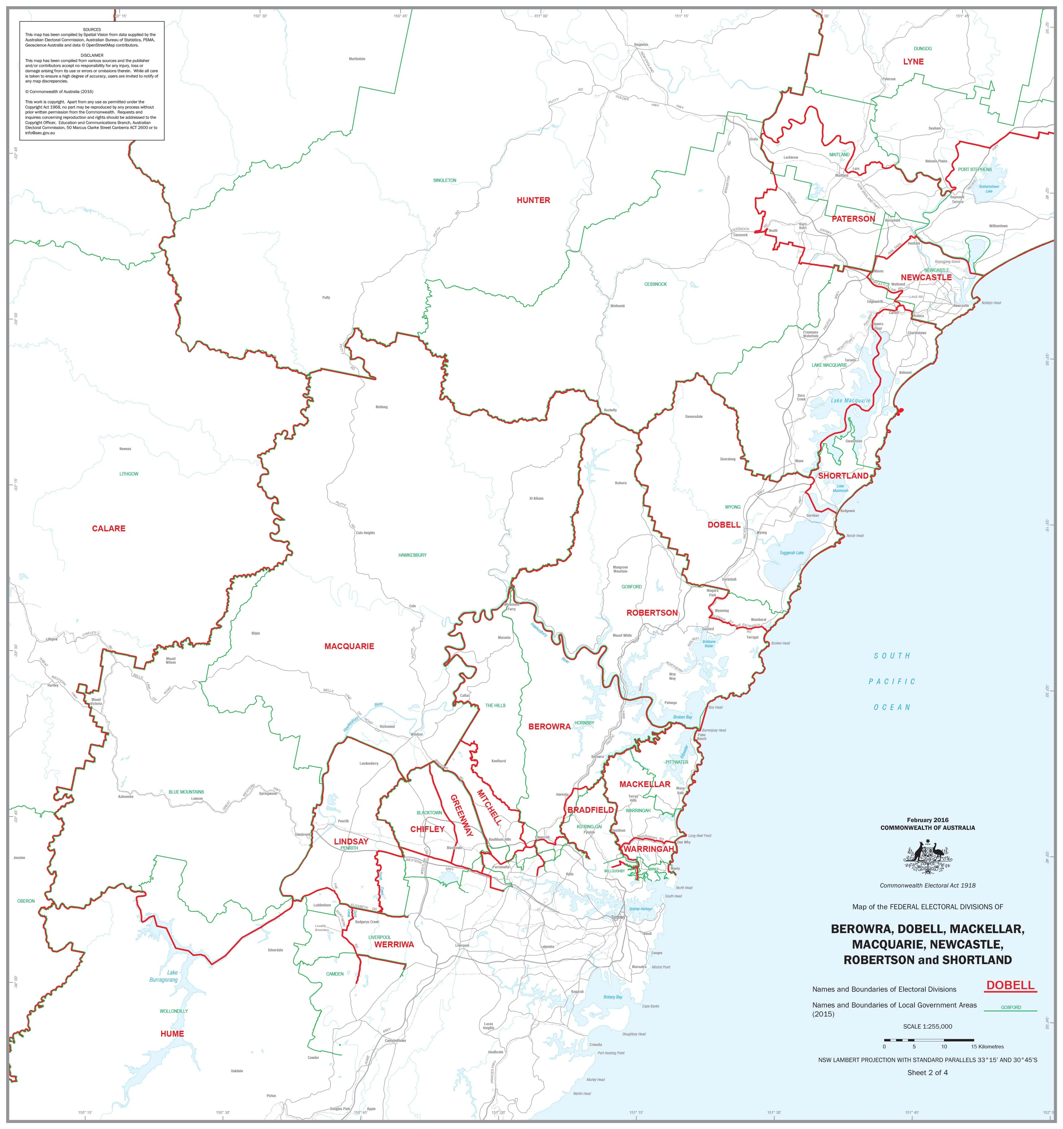
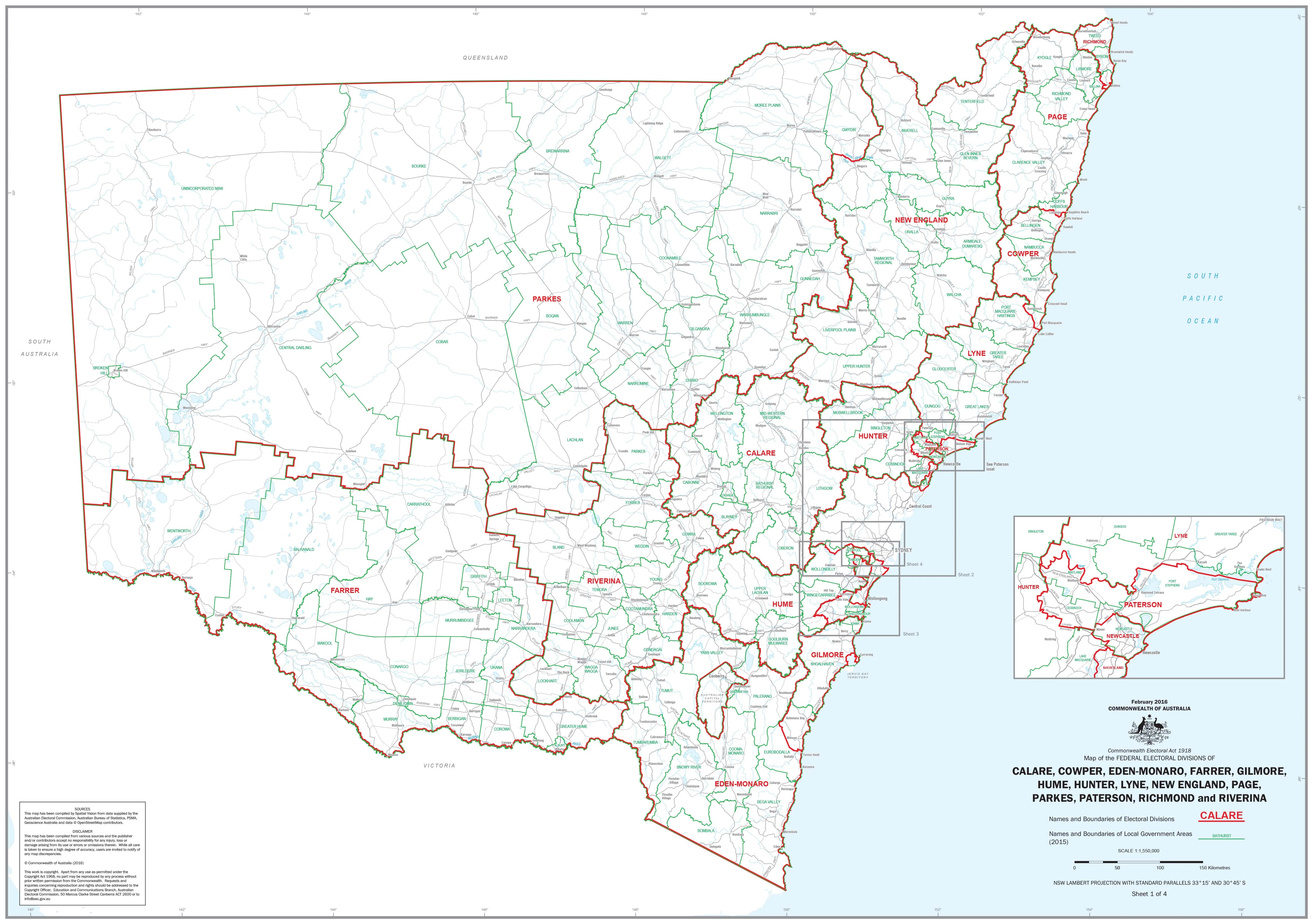
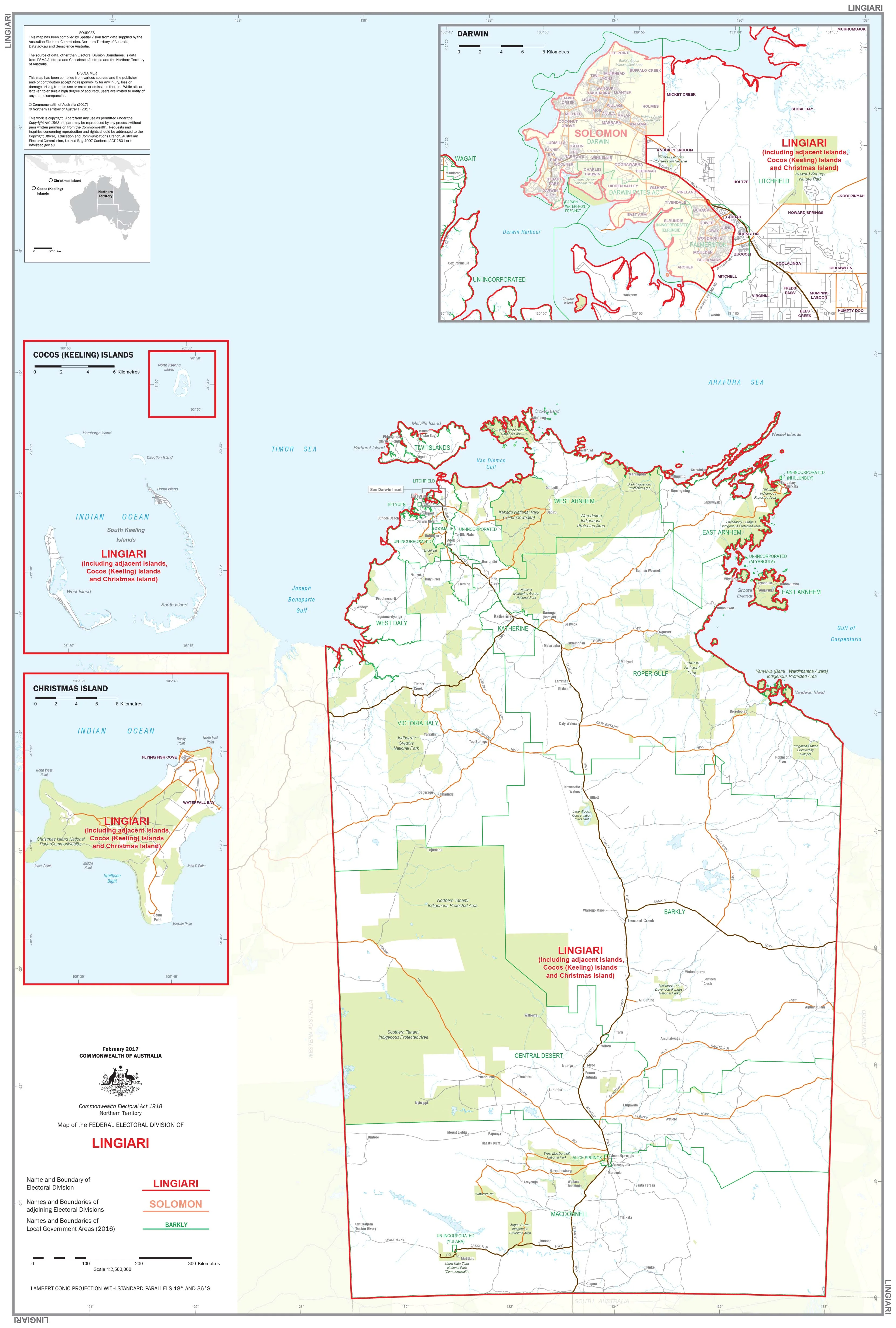
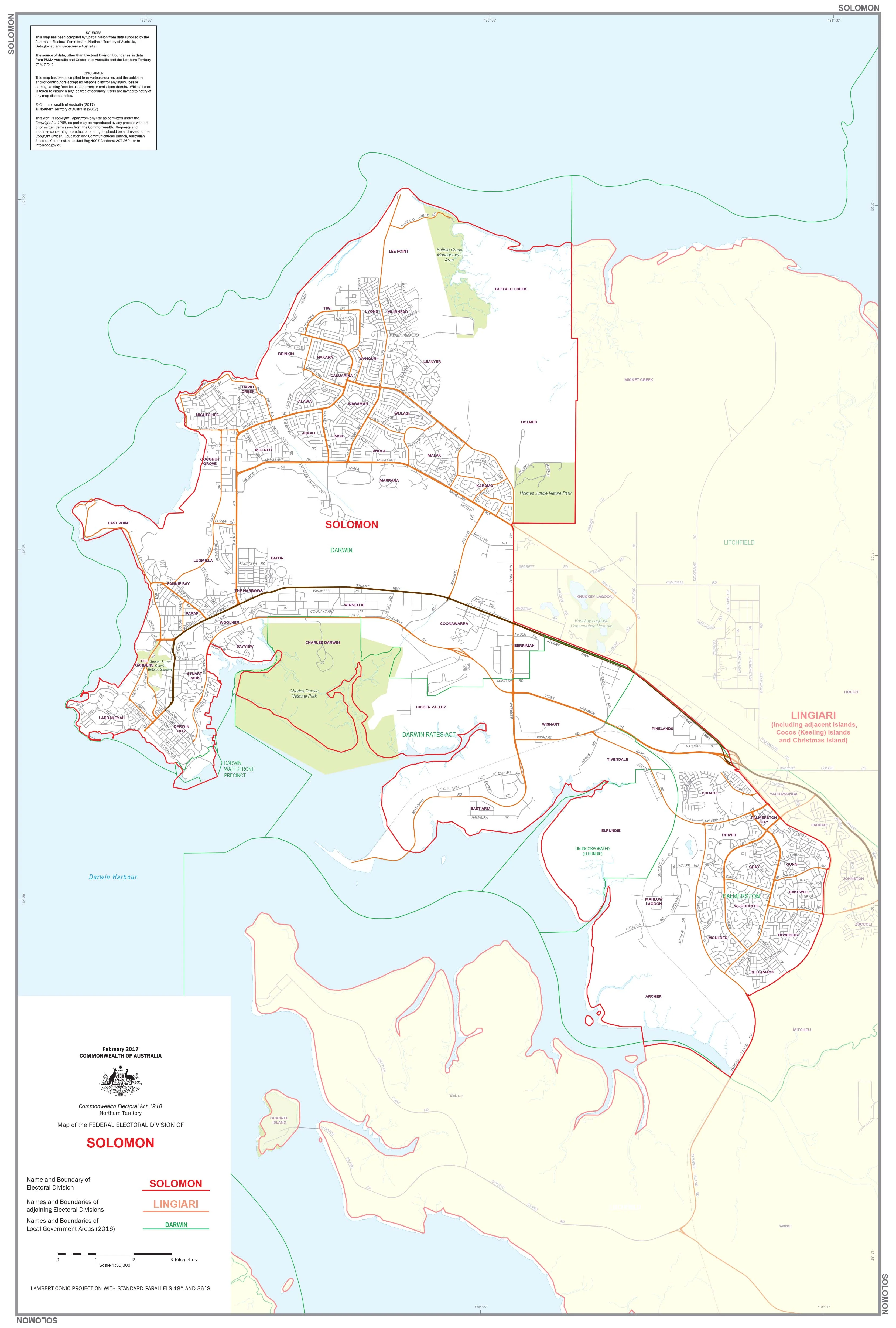
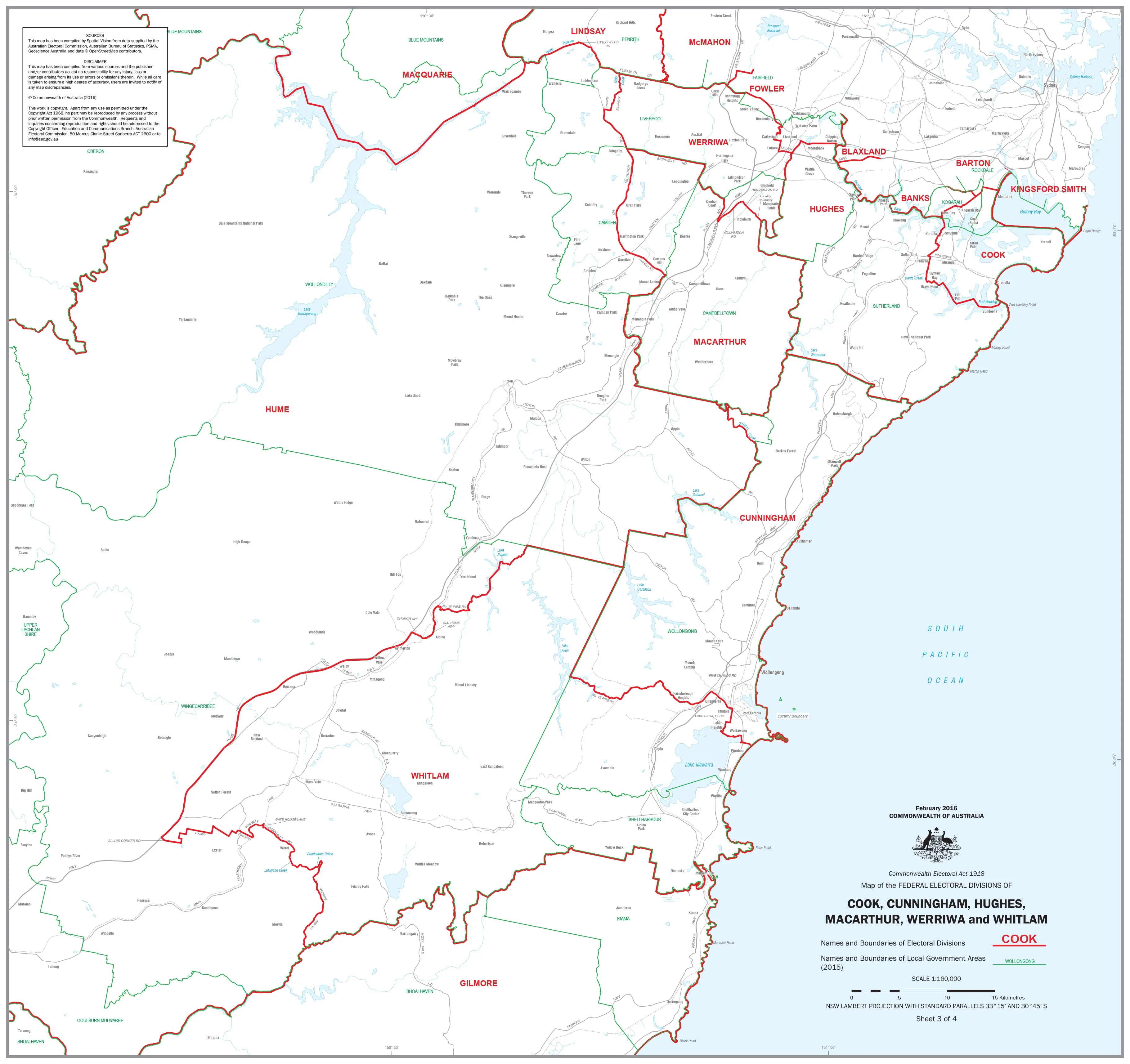
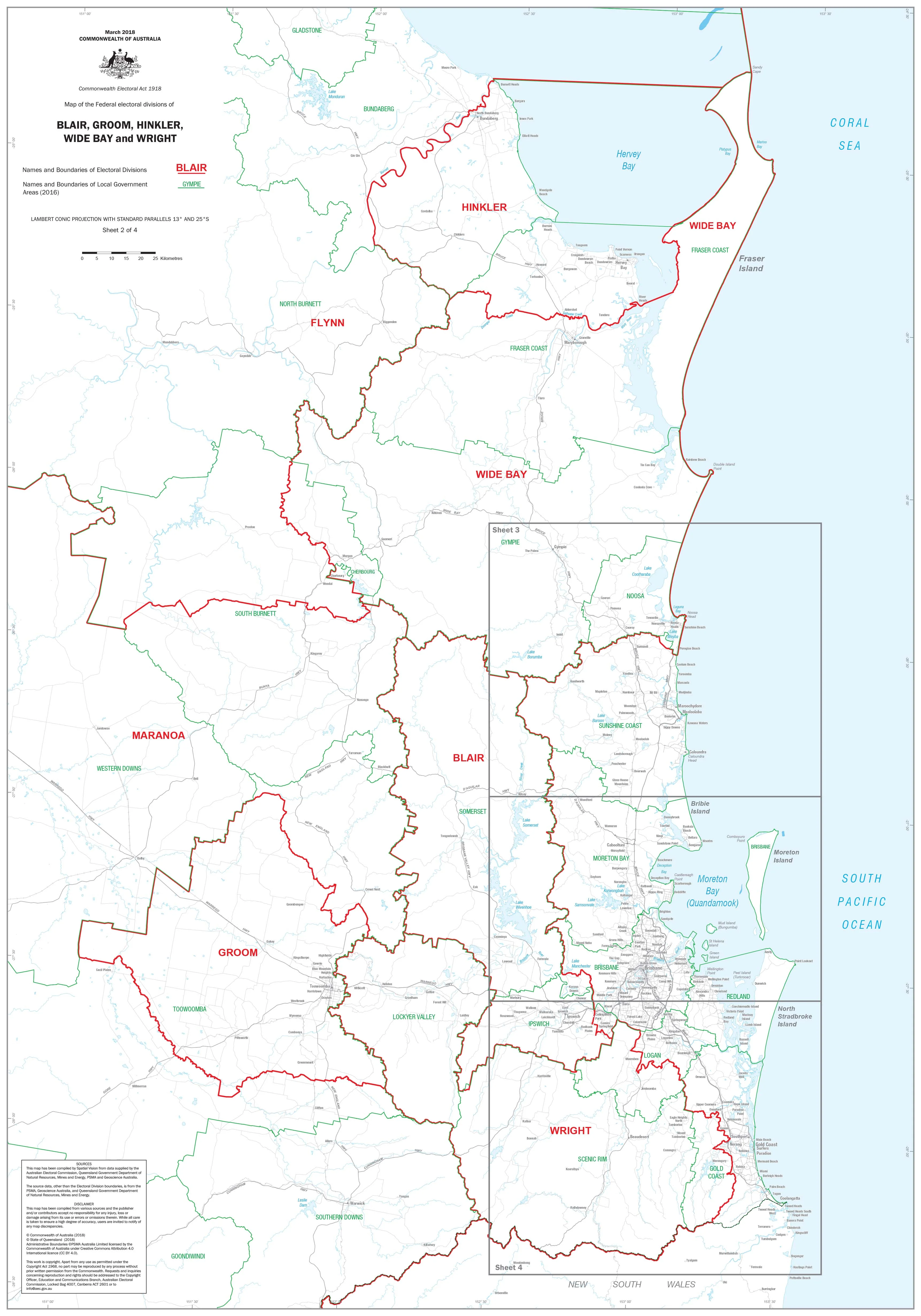
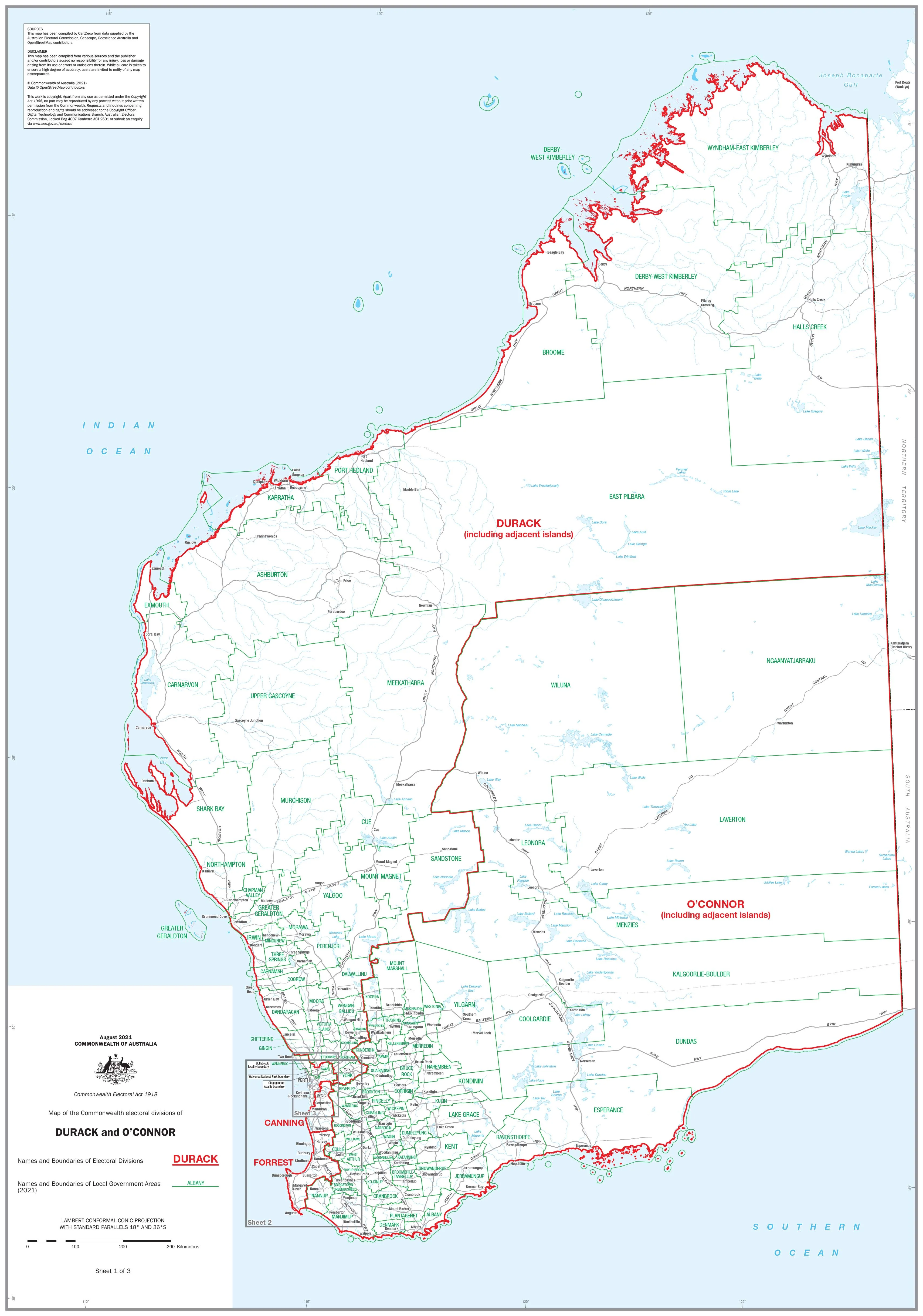
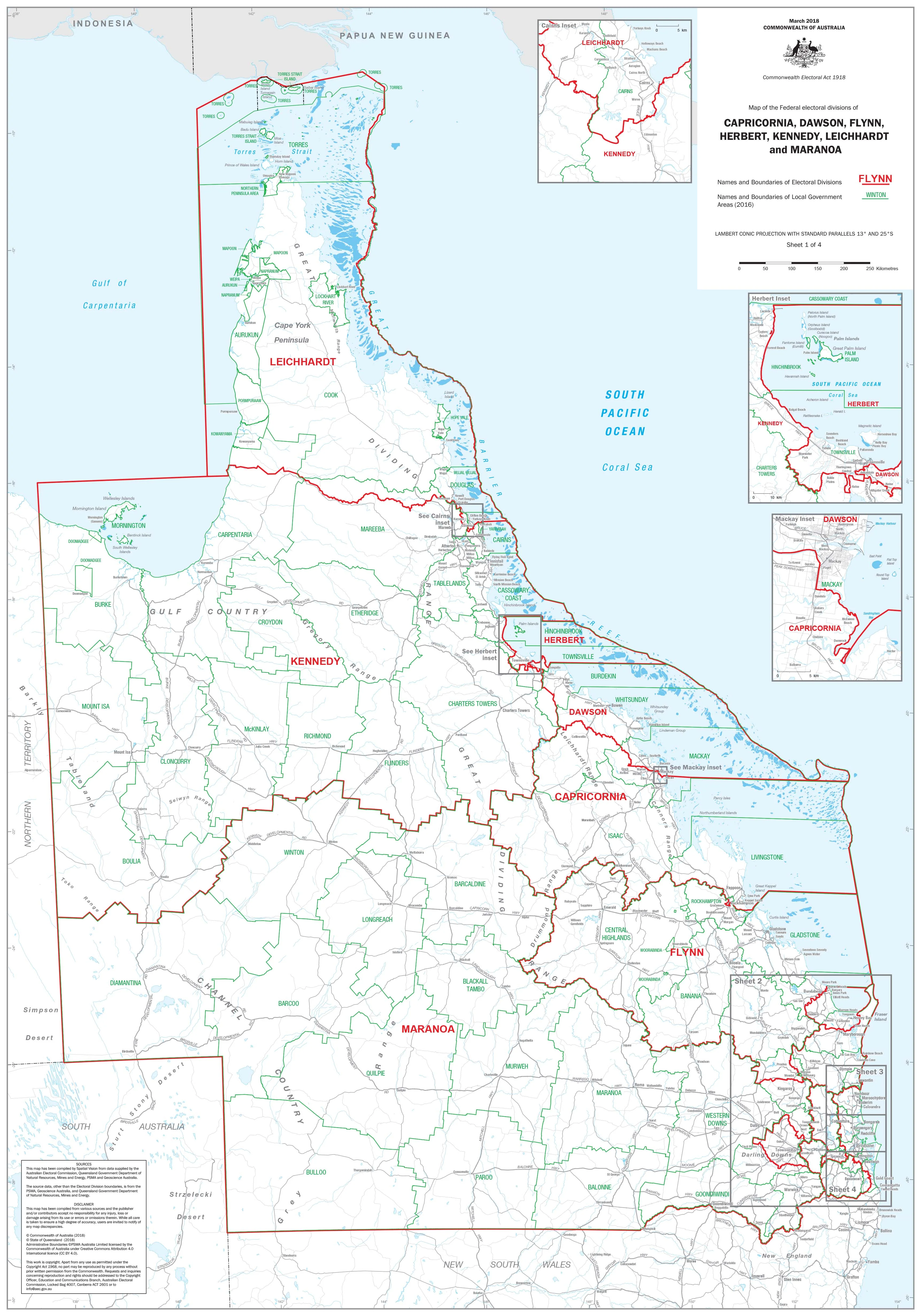
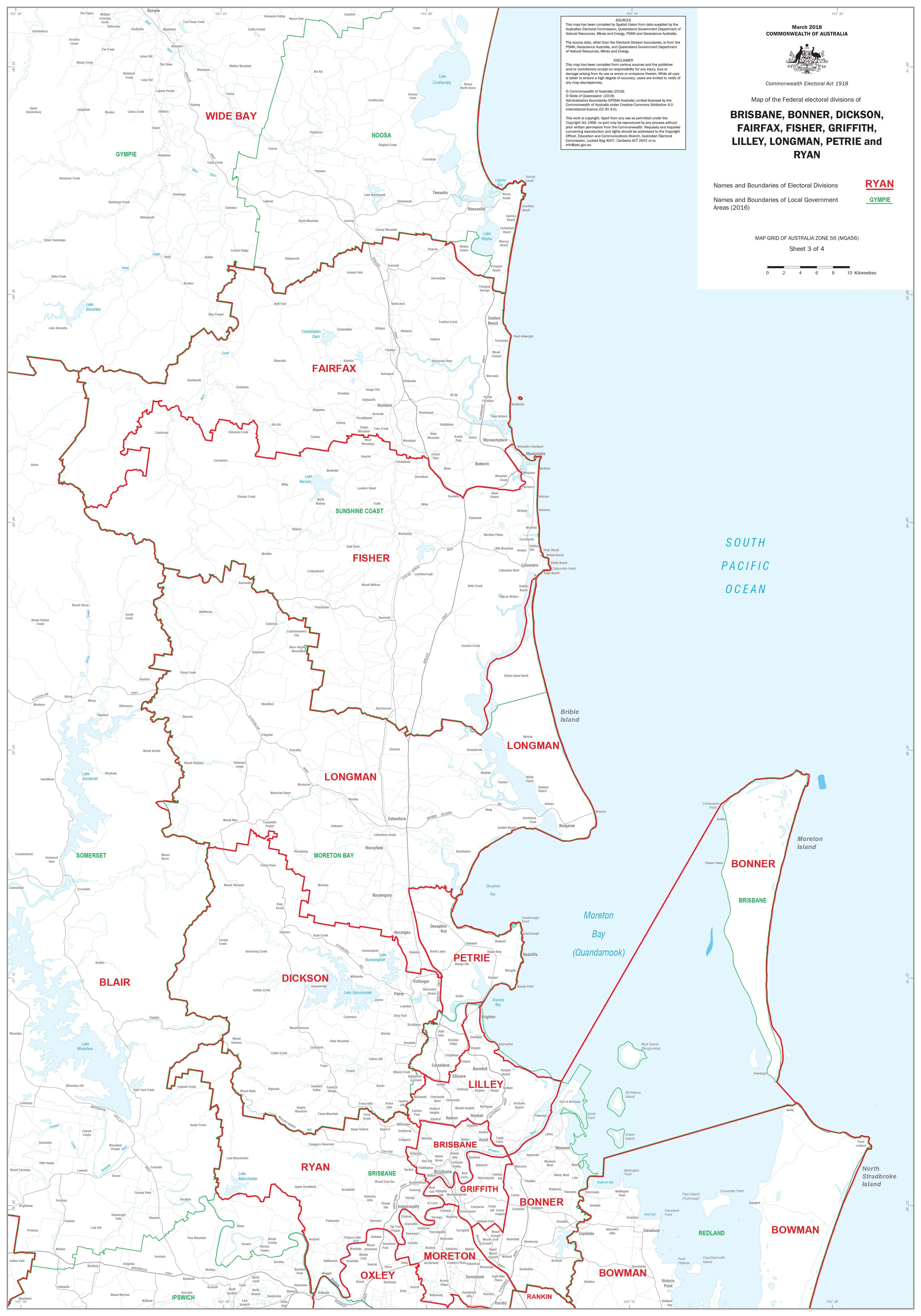
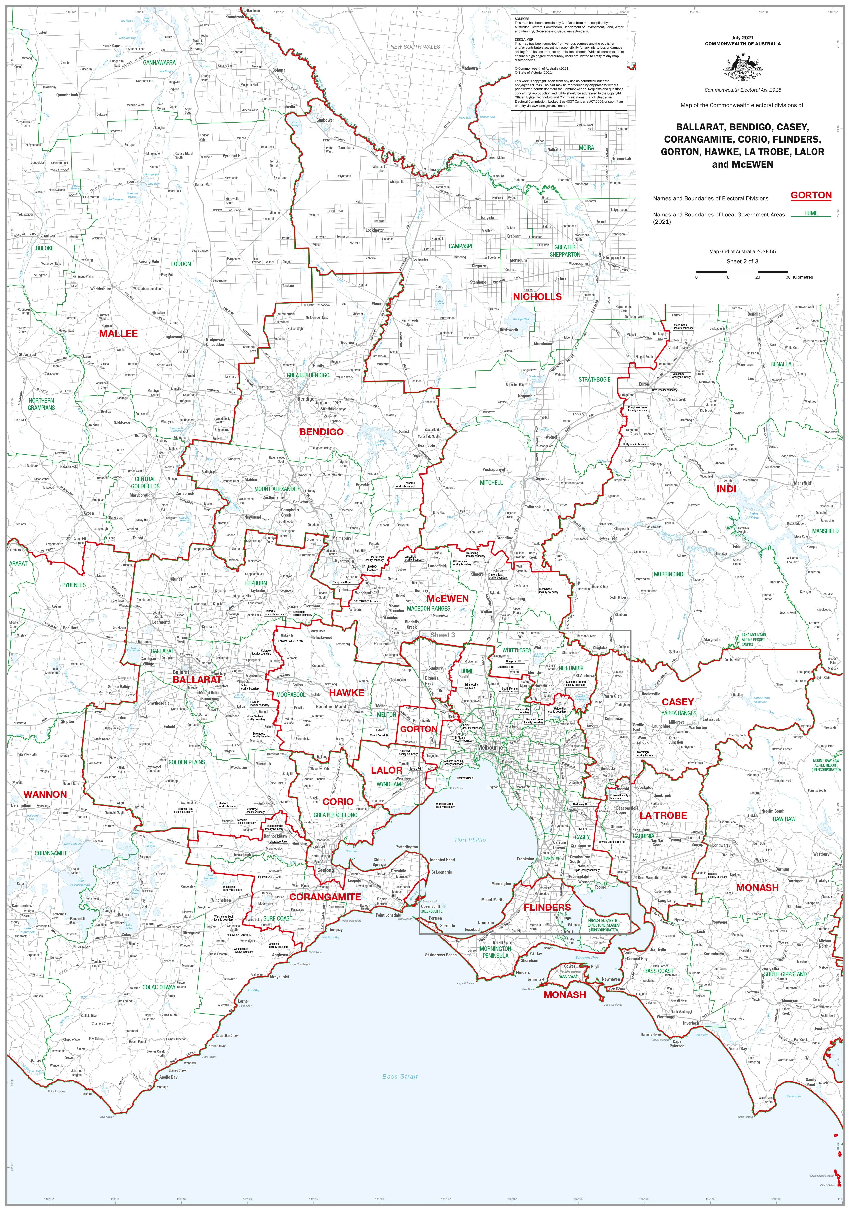
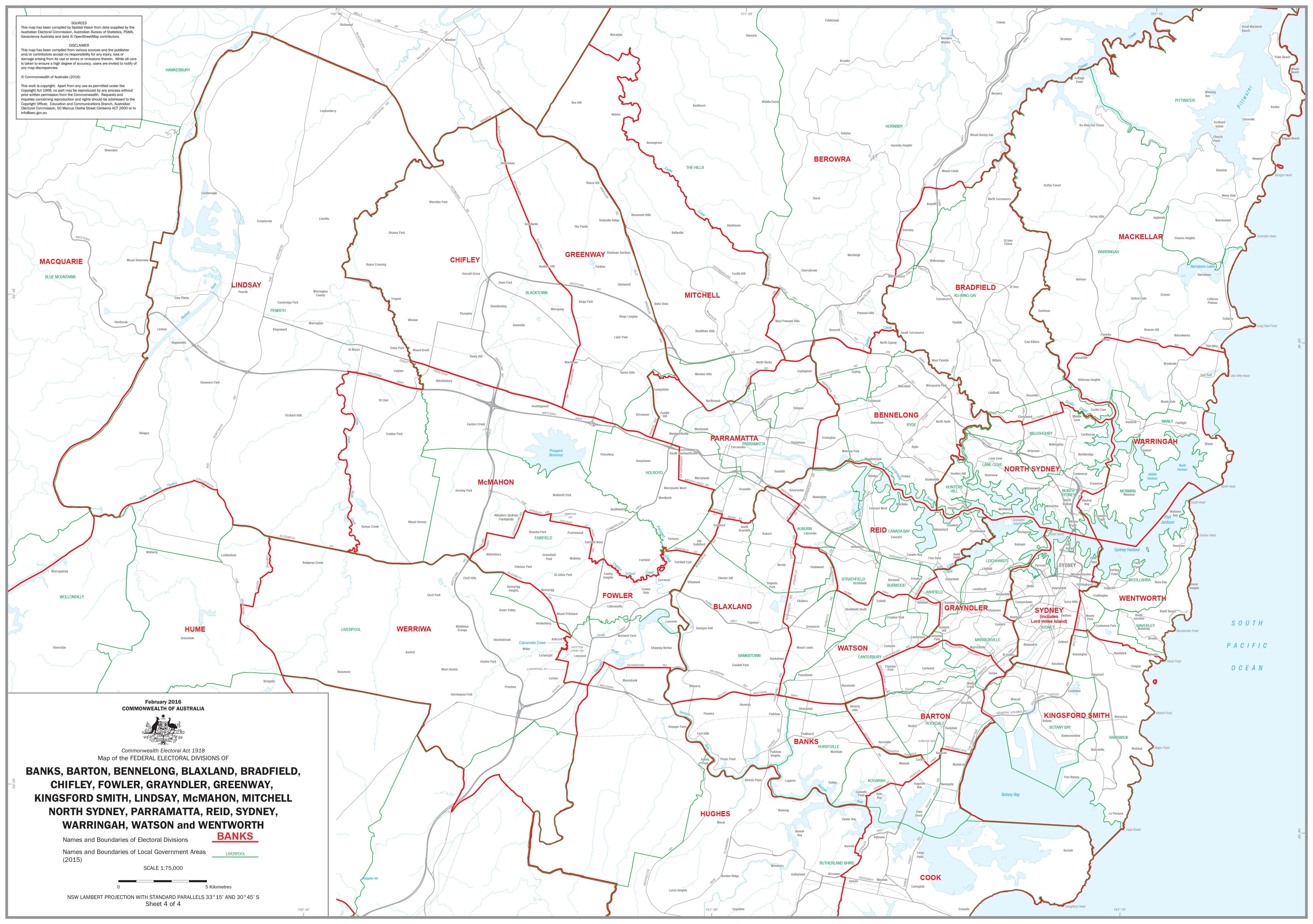
The New South Wales Federal Electoral Divisions and Local Government Areas Map provides a detailed and up-to-date view of Sydney and its surrounding regions. Designed for clarity, it shows federal electoral boundaries alongside local government area (LGA) boundaries, making it an invaluable reference for government, education, business, and community use.
Covering the Sydney metropolitan area and surrounding districts, this large-format wall map combines electoral geography with local administration — ideal for planning, analysis, or display.
🗝️ Key Features
-
Federal electoral divisions — Boundaries clearly marked across Sydney and surrounding areas
-
Local government areas — All LGAs distinguished with clear labelling
-
Comprehensive coverage — Focus on the Sydney metro region and adjoining districts
-
Practical for planning — Essential for government agencies, political offices, schools, and businesses
-
Large-format design — Easy to read at a glance, suitable for offices and classrooms
🎨 Materials & Finish
-
📄 Paper (160 gsm matte): Archival-quality, perfect for framing under glass.
-
💧 Laminated (True Encapsulation): 2 × 80-micron gloss laminate, waterproof, tear-resistant, and wipe-clean.
-
🪵 Laminated + Timber Hang Rails: Professionally mounted with natural lacquered timber rails and hanging cord; ready to display.
-
🎨 Canvas (395 gsm HP Professional Matte): Printed on museum-grade canvas with pigment-based inks for a premium, durable finish.
-
🪵 Canvas + Timber Hang Rails: Gallery-quality presentation with canvas mounted in lacquered timber rails; ready to hang.
⚠️ Please allow up to 10 working days for delivery of hang-railed maps, as each is custom-finished by our framer.
📐 Size
-
Dimensions: 1000 mm (w) x 700 mm (h)
-
Orientation: Portrait
📊 Specifications
| Attribute | Details |
|---|---|
| Title | NSW Federal Electoral Divisions & Local Government Areas — Sydney & Area |
| Coverage | Sydney metropolitan region and adjoining areas |
| Features | Federal electoral boundaries, local government areas, clear labels |
| Format Options | Paper, Laminated, Laminated + Timber Hang Rails, Canvas, Canvas + Timber Hang Rails |
| Paper Weight | 160 gsm archival matte |
| Laminate | 2 × 80-micron gloss (true encapsulation) |
| Canvas | 395 gsm HP Professional Matte |
| Inks | Pigment-based, fade-resistant |
| Optional Hang Rails | Natural timber, lacquered; top cord included |
| Origin | Printed in Australia |
🎯 Who it’s for
-
🏛️ Government & electoral offices — Electoral planning and analysis
-
🏢 Businesses & community organisations — Understanding local government areas
-
🎓 Schools & universities — Teaching civics, geography, and political studies
-
📍 Community groups & researchers — Clear boundary reference for projects and reports
🤝 Our Commitment
All maps are printed and finished locally in Australia, using archival-quality materials and fade-resistant inks. Each copy is hand-checked, carefully packed, and professionally finished, ensuring it arrives ready for reference or display.
🛒 Order your NSW Federal Electoral Divisions & Local Government Areas Map (Sydney & Area) today — a clear and authoritative guide to Sydney’s electoral and local government boundaries.
Original: $42.89
-65%$42.89
$15.01Product Information
Product Information
Shipping & Returns
Shipping & Returns
Description
New South Wales — Federal Electoral Divisions & Local Government Areas Map (Sydney & Surrounds)
The New South Wales Federal Electoral Divisions and Local Government Areas Map provides a detailed and up-to-date view of Sydney and its surrounding regions. Designed for clarity, it shows federal electoral boundaries alongside local government area (LGA) boundaries, making it an invaluable reference for government, education, business, and community use.
Covering the Sydney metropolitan area and surrounding districts, this large-format wall map combines electoral geography with local administration — ideal for planning, analysis, or display.
🗝️ Key Features
-
Federal electoral divisions — Boundaries clearly marked across Sydney and surrounding areas
-
Local government areas — All LGAs distinguished with clear labelling
-
Comprehensive coverage — Focus on the Sydney metro region and adjoining districts
-
Practical for planning — Essential for government agencies, political offices, schools, and businesses
-
Large-format design — Easy to read at a glance, suitable for offices and classrooms
🎨 Materials & Finish
-
📄 Paper (160 gsm matte): Archival-quality, perfect for framing under glass.
-
💧 Laminated (True Encapsulation): 2 × 80-micron gloss laminate, waterproof, tear-resistant, and wipe-clean.
-
🪵 Laminated + Timber Hang Rails: Professionally mounted with natural lacquered timber rails and hanging cord; ready to display.
-
🎨 Canvas (395 gsm HP Professional Matte): Printed on museum-grade canvas with pigment-based inks for a premium, durable finish.
-
🪵 Canvas + Timber Hang Rails: Gallery-quality presentation with canvas mounted in lacquered timber rails; ready to hang.
⚠️ Please allow up to 10 working days for delivery of hang-railed maps, as each is custom-finished by our framer.
📐 Size
-
Dimensions: 1000 mm (w) x 700 mm (h)
-
Orientation: Portrait
📊 Specifications
| Attribute | Details |
|---|---|
| Title | NSW Federal Electoral Divisions & Local Government Areas — Sydney & Area |
| Coverage | Sydney metropolitan region and adjoining areas |
| Features | Federal electoral boundaries, local government areas, clear labels |
| Format Options | Paper, Laminated, Laminated + Timber Hang Rails, Canvas, Canvas + Timber Hang Rails |
| Paper Weight | 160 gsm archival matte |
| Laminate | 2 × 80-micron gloss (true encapsulation) |
| Canvas | 395 gsm HP Professional Matte |
| Inks | Pigment-based, fade-resistant |
| Optional Hang Rails | Natural timber, lacquered; top cord included |
| Origin | Printed in Australia |
🎯 Who it’s for
-
🏛️ Government & electoral offices — Electoral planning and analysis
-
🏢 Businesses & community organisations — Understanding local government areas
-
🎓 Schools & universities — Teaching civics, geography, and political studies
-
📍 Community groups & researchers — Clear boundary reference for projects and reports
🤝 Our Commitment
All maps are printed and finished locally in Australia, using archival-quality materials and fade-resistant inks. Each copy is hand-checked, carefully packed, and professionally finished, ensuring it arrives ready for reference or display.
🛒 Order your NSW Federal Electoral Divisions & Local Government Areas Map (Sydney & Area) today — a clear and authoritative guide to Sydney’s electoral and local government boundaries.