New South Wales Primary Health Care Network - Metropolitan Area Wall Map
New South Wales Primary Health Care Network — Metropolitan Area Wall Map
A clear, practical view of how primary health care is organised across metropolitan New South Wales
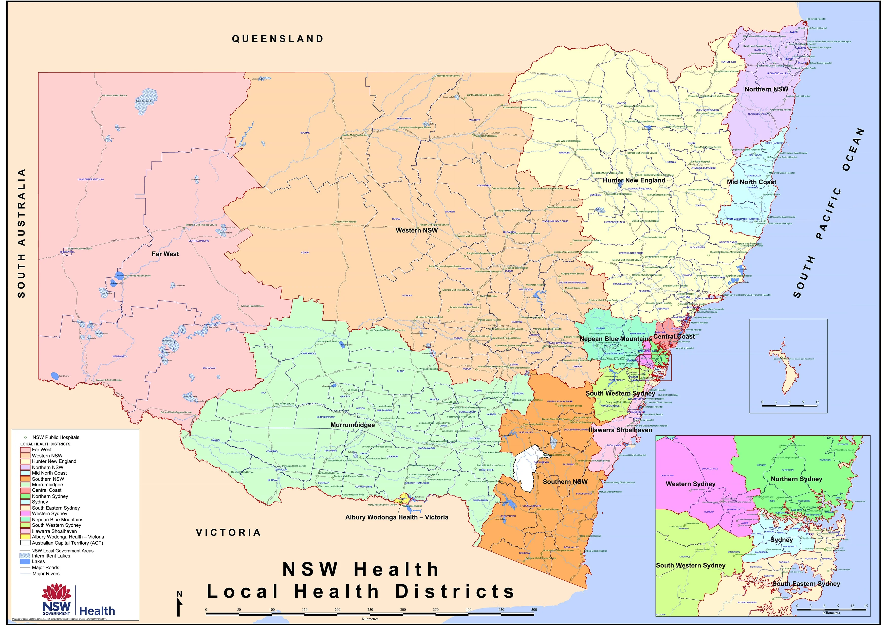
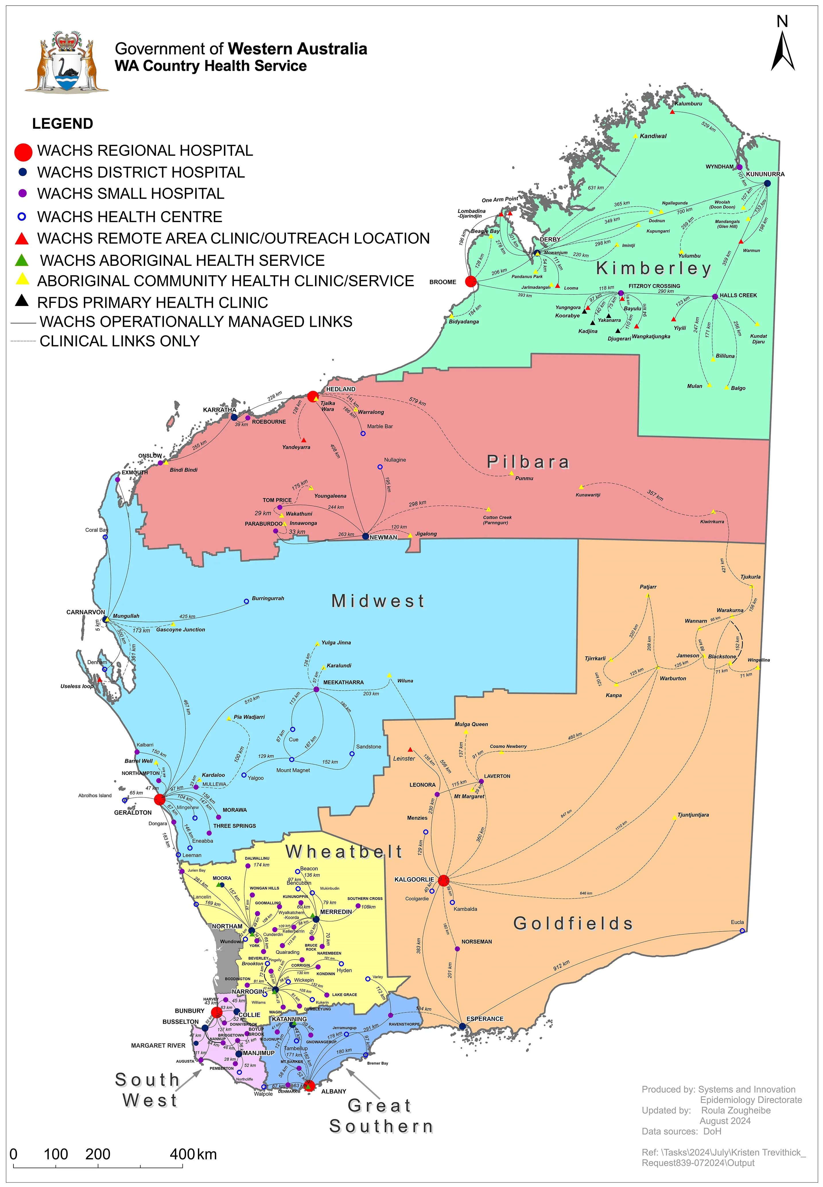
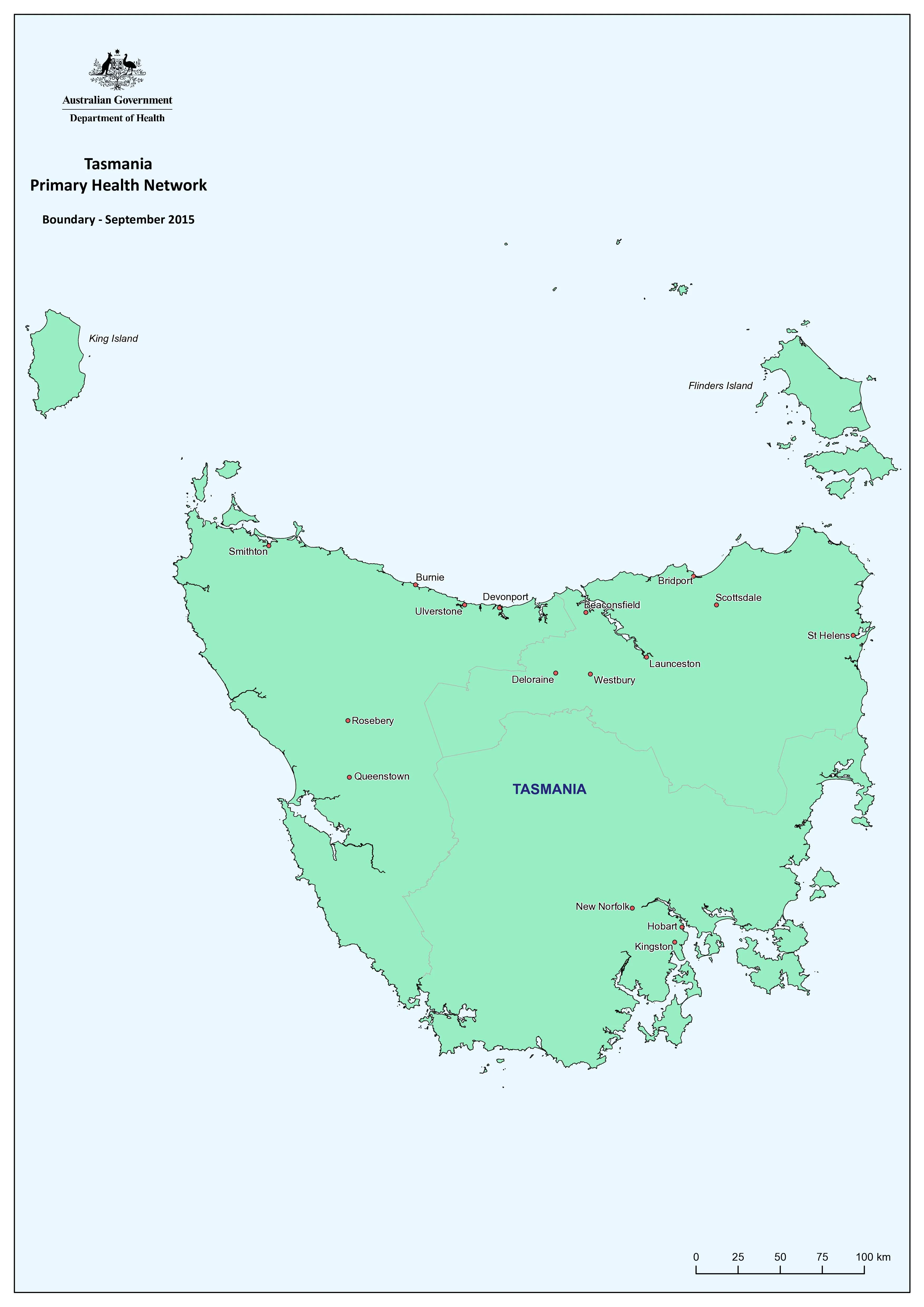
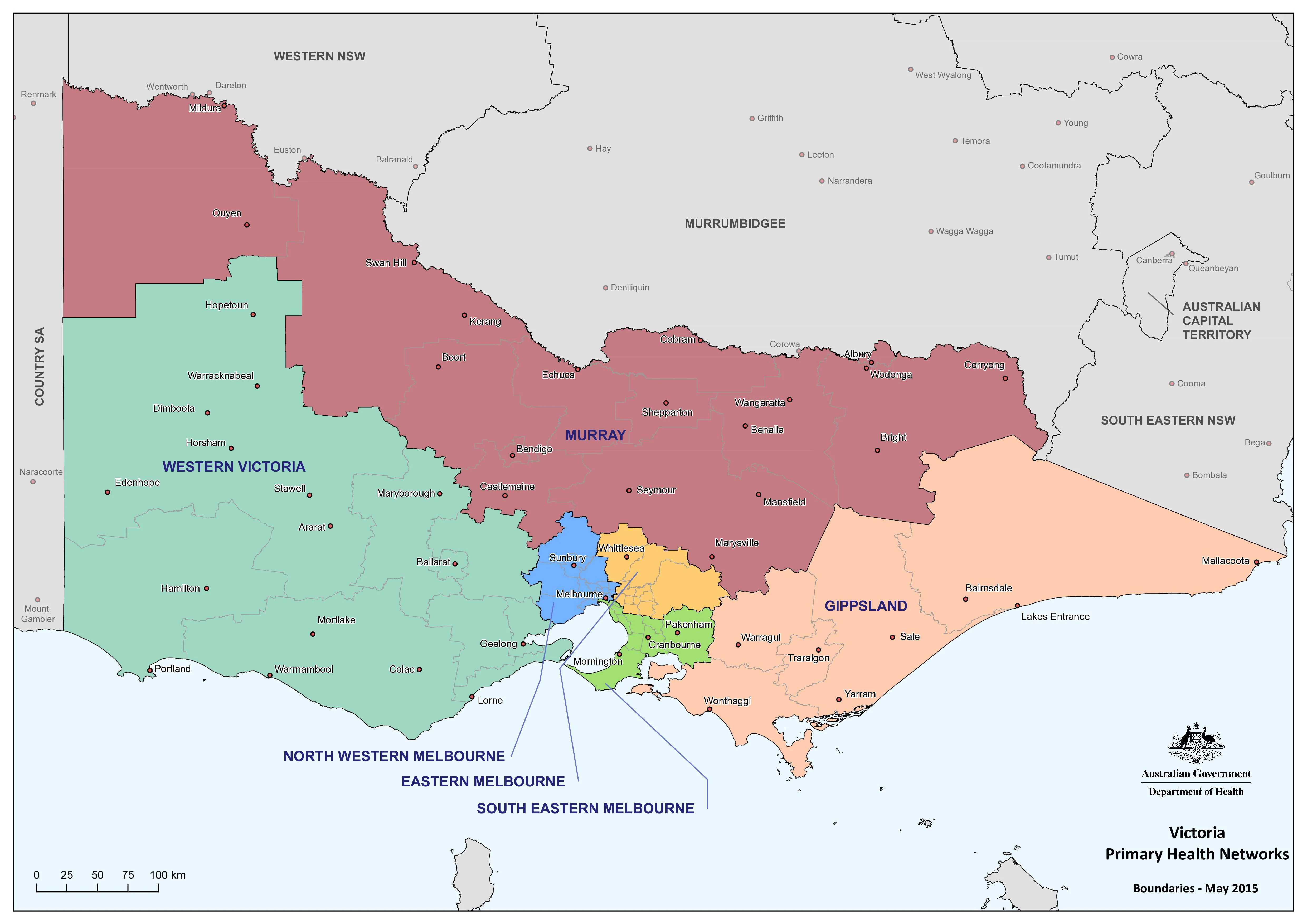
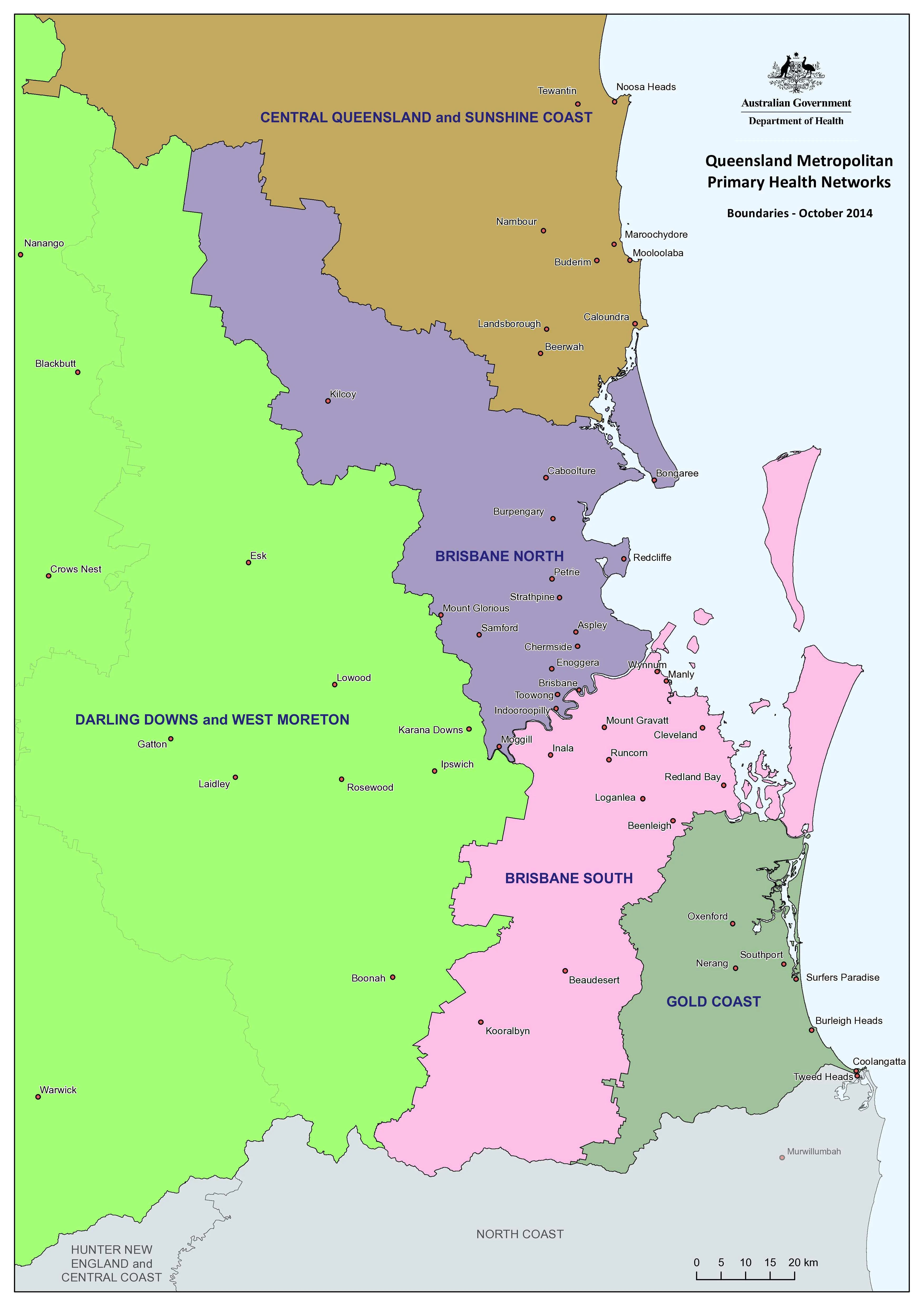
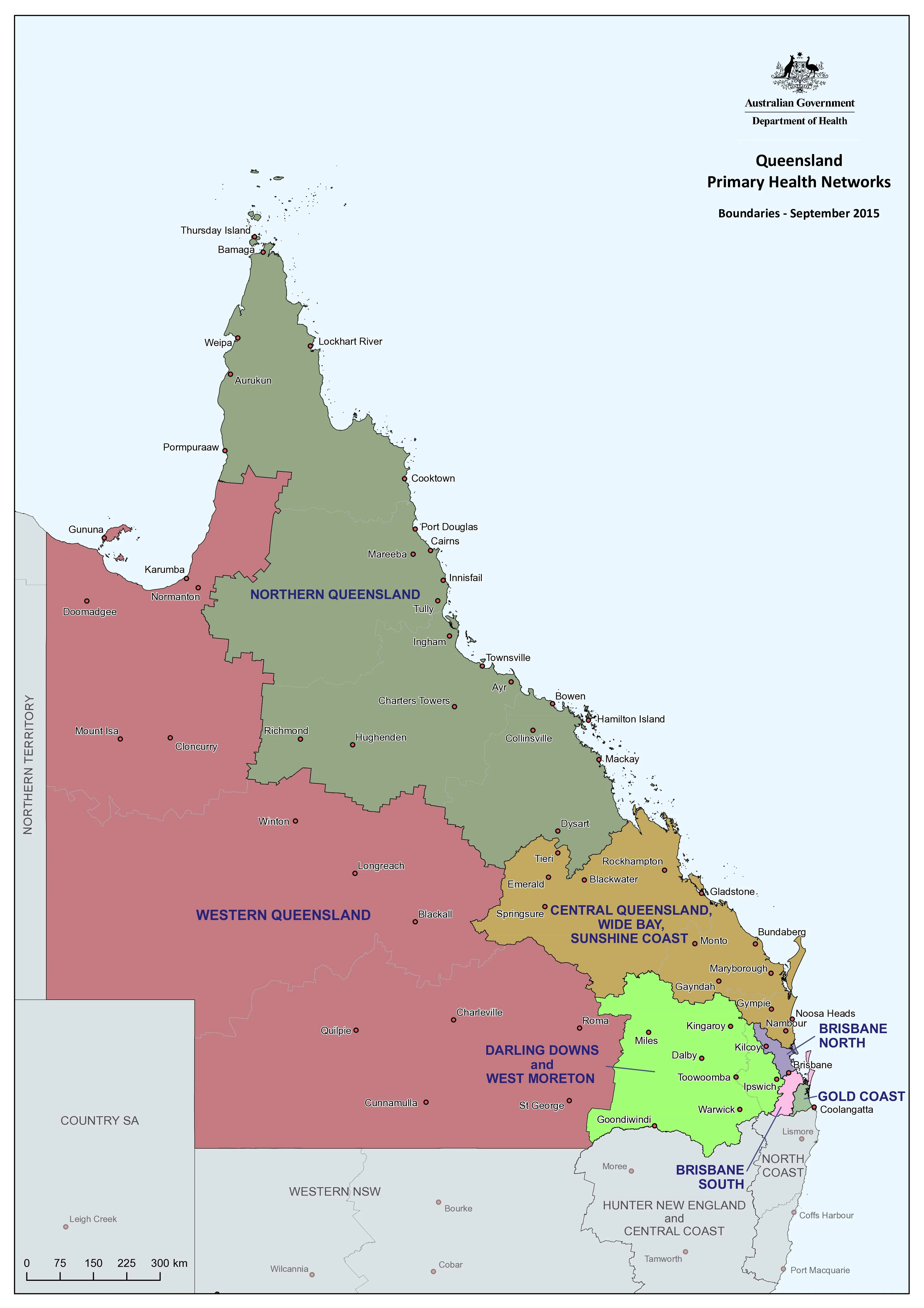
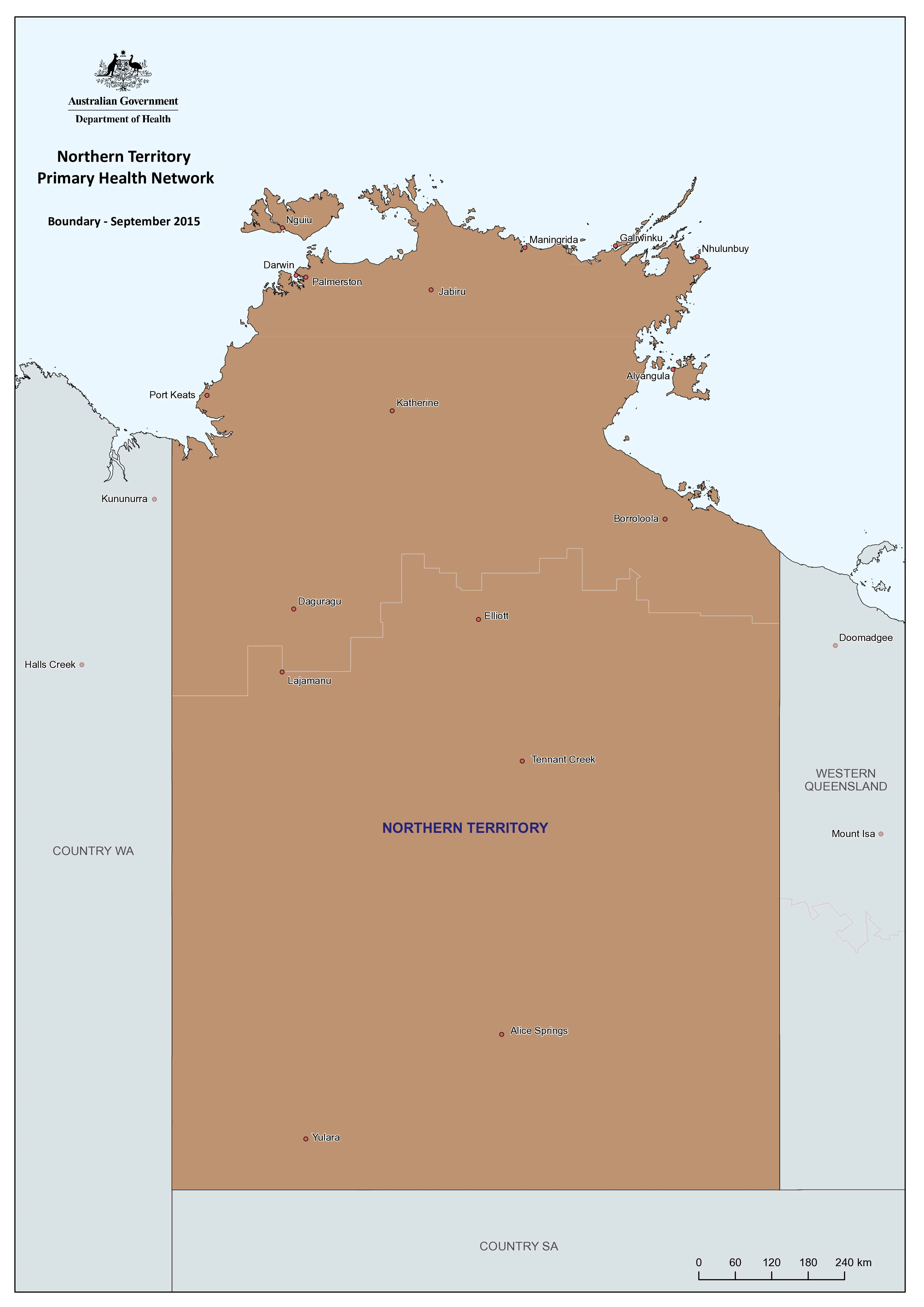
This New South Wales Primary Health Care Network (PHN) — Metropolitan Area Wall Map presents a clean, authoritative overview of PHN boundaries across Sydney and surrounding metropolitan regions. Designed for clarity and real-world use, it supports planning, coordination, and communication across the primary health system.
Primary Health Networks are independent organisations funded by the Australian Government to improve the efficiency and effectiveness of medical services for patients, particularly those at risk of poor health outcomes. This map brings that structure into sharp, wall-scale focus.
🩺 What the Map Represents
The map visualises the metropolitan footprint of Primary Health Networks in New South Wales, supporting their three core functions:
-
Coordination & integration
Showing how PHNs align with Local Hospital Networks (LHNs) to improve quality of care, patient experience, and efficient use of resources. -
Commissioning of services
Supporting planning and delivery of primary care and mental health services to address population health needs, service gaps, access, and equity. -
Capacity building & practice support
Providing a spatial framework to support GPs, allied health, and mental health providers in delivering consistent, high-quality care.
🎯 Why This Map Matters
-
Strategic planning tool for health administrators and policy teams
-
Operational clarity for commissioning, service design, and regional collaboration
-
Communication aid for briefings, meetings, and stakeholder engagement
-
Educational reference for understanding metropolitan PHN coverage at a glance
Purpose-built and uncluttered, this is a wall map made to be read, referenced, and relied upon.
📐 Size & Format
-
1000 mm (w) × 700 mm (h)
-
Orientation: Landscape
-
Designed for wall display in offices, health facilities, and meeting spaces
✨ Premium Print & Display Options
Each map is printed in Australia using archival processes to preserve fine linework, colour accuracy, and long-term durability.
Available finishes:
-
📄 Heavyweight Paper (160 gsm matte)
Archival matte surface with excellent definition; ideal for framing under glass. -
🔒 Laminated (True Encapsulation)
Sealed edge-to-edge between 2 × 80-micron gloss laminate; tear-resistant, wipe-clean, and highly durable. -
🪵 Laminated + Timber Hang Rails
Laminated map fitted with natural lacquered timber hang rails (top & bottom), supplied with hanging cord.
Please allow up to 10 working days. -
🎨 Archival Canvas (395 gsm HP Professional Matte)
Pigment-based, fade-resistant inks on heavyweight canvas for a refined, gallery-style presentation. -
🪵 Canvas + Timber Hang Rails
Canvas finished with natural timber rails for a frame-free, ready-to-hang display.
Please allow up to 10 working days.
🏥 Ideal For
🏢 Primary Health Networks & health departments
🏥 Hospitals & Local Health Districts
📊 Policy, planning & commissioning teams
🎓 Universities & health education providers
🤝 NGOs and community health organisations
🇦🇺 Our Commitment
Printed locally in Australia, every map is professionally colour-managed, hand-checked, and carefully packed to ensure clarity, durability, and consistency.
A practical, no-nonsense reference map — built to support collaboration, planning, and better health outcomes across metropolitan New South Wales.
Original: $50.05
-65%$50.05
$17.52Product Information
Product Information
Shipping & Returns
Shipping & Returns
Description
New South Wales Primary Health Care Network — Metropolitan Area Wall Map
A clear, practical view of how primary health care is organised across metropolitan New South Wales
This New South Wales Primary Health Care Network (PHN) — Metropolitan Area Wall Map presents a clean, authoritative overview of PHN boundaries across Sydney and surrounding metropolitan regions. Designed for clarity and real-world use, it supports planning, coordination, and communication across the primary health system.
Primary Health Networks are independent organisations funded by the Australian Government to improve the efficiency and effectiveness of medical services for patients, particularly those at risk of poor health outcomes. This map brings that structure into sharp, wall-scale focus.
🩺 What the Map Represents
The map visualises the metropolitan footprint of Primary Health Networks in New South Wales, supporting their three core functions:
-
Coordination & integration
Showing how PHNs align with Local Hospital Networks (LHNs) to improve quality of care, patient experience, and efficient use of resources. -
Commissioning of services
Supporting planning and delivery of primary care and mental health services to address population health needs, service gaps, access, and equity. -
Capacity building & practice support
Providing a spatial framework to support GPs, allied health, and mental health providers in delivering consistent, high-quality care.
🎯 Why This Map Matters
-
Strategic planning tool for health administrators and policy teams
-
Operational clarity for commissioning, service design, and regional collaboration
-
Communication aid for briefings, meetings, and stakeholder engagement
-
Educational reference for understanding metropolitan PHN coverage at a glance
Purpose-built and uncluttered, this is a wall map made to be read, referenced, and relied upon.
📐 Size & Format
-
1000 mm (w) × 700 mm (h)
-
Orientation: Landscape
-
Designed for wall display in offices, health facilities, and meeting spaces
✨ Premium Print & Display Options
Each map is printed in Australia using archival processes to preserve fine linework, colour accuracy, and long-term durability.
Available finishes:
-
📄 Heavyweight Paper (160 gsm matte)
Archival matte surface with excellent definition; ideal for framing under glass. -
🔒 Laminated (True Encapsulation)
Sealed edge-to-edge between 2 × 80-micron gloss laminate; tear-resistant, wipe-clean, and highly durable. -
🪵 Laminated + Timber Hang Rails
Laminated map fitted with natural lacquered timber hang rails (top & bottom), supplied with hanging cord.
Please allow up to 10 working days. -
🎨 Archival Canvas (395 gsm HP Professional Matte)
Pigment-based, fade-resistant inks on heavyweight canvas for a refined, gallery-style presentation. -
🪵 Canvas + Timber Hang Rails
Canvas finished with natural timber rails for a frame-free, ready-to-hang display.
Please allow up to 10 working days.
🏥 Ideal For
🏢 Primary Health Networks & health departments
🏥 Hospitals & Local Health Districts
📊 Policy, planning & commissioning teams
🎓 Universities & health education providers
🤝 NGOs and community health organisations
🇦🇺 Our Commitment
Printed locally in Australia, every map is professionally colour-managed, hand-checked, and carefully packed to ensure clarity, durability, and consistency.
A practical, no-nonsense reference map — built to support collaboration, planning, and better health outcomes across metropolitan New South Wales.