New South Wales Primary Health Networks Wall Map (2026)
New South Wales — Primary Health Networks Wall Map (2026 Edition)
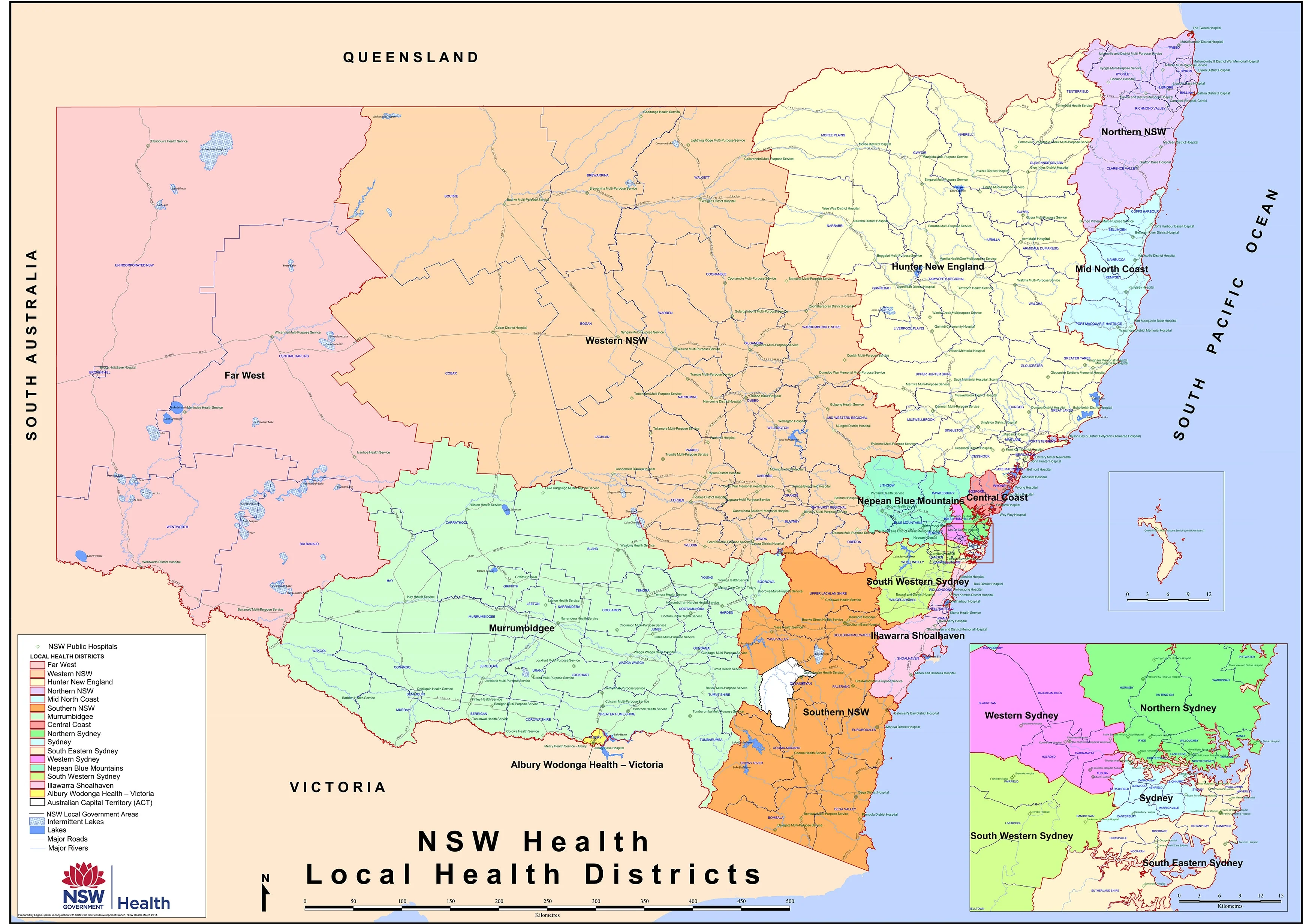
A clear, authoritative wall map of New South Wales’ Primary Health Network (PHN) boundaries — 2026 Edition, designed for planners, clinicians, administrators, and educators who need immediate geographic clarity.
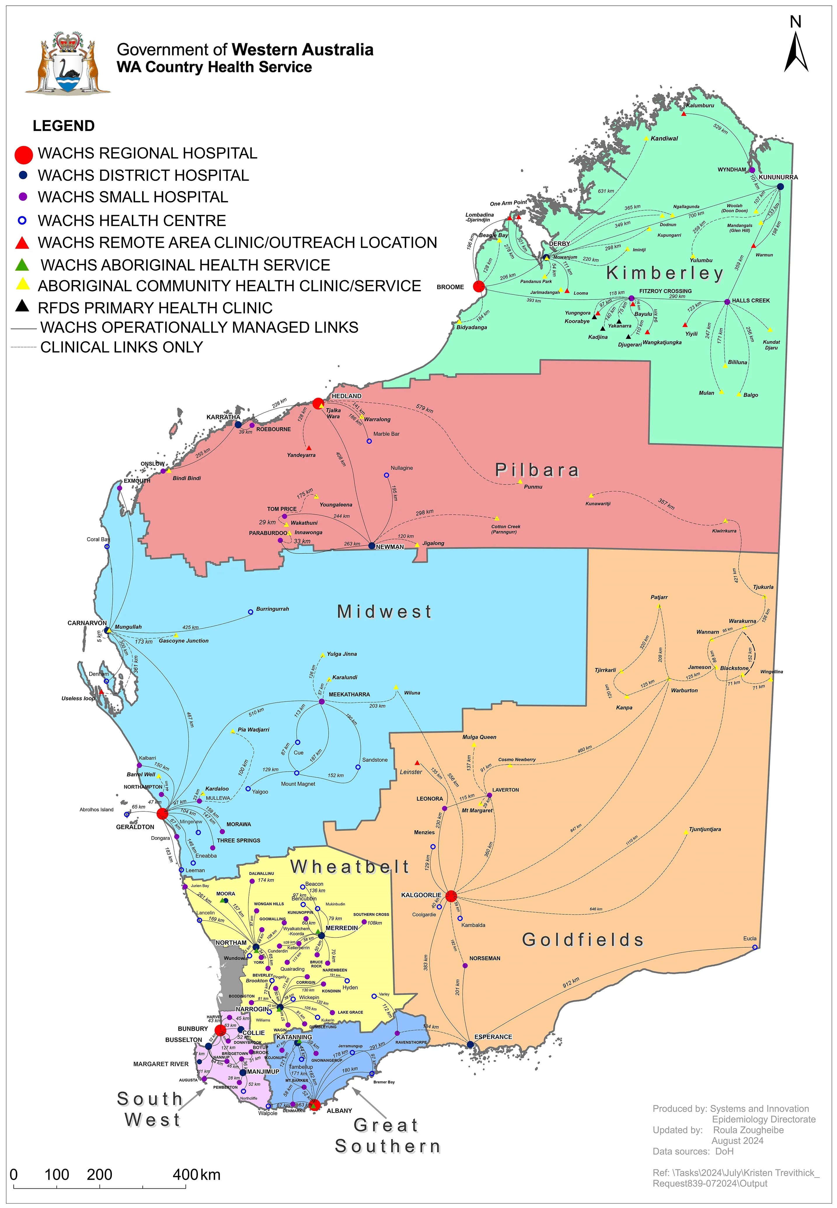
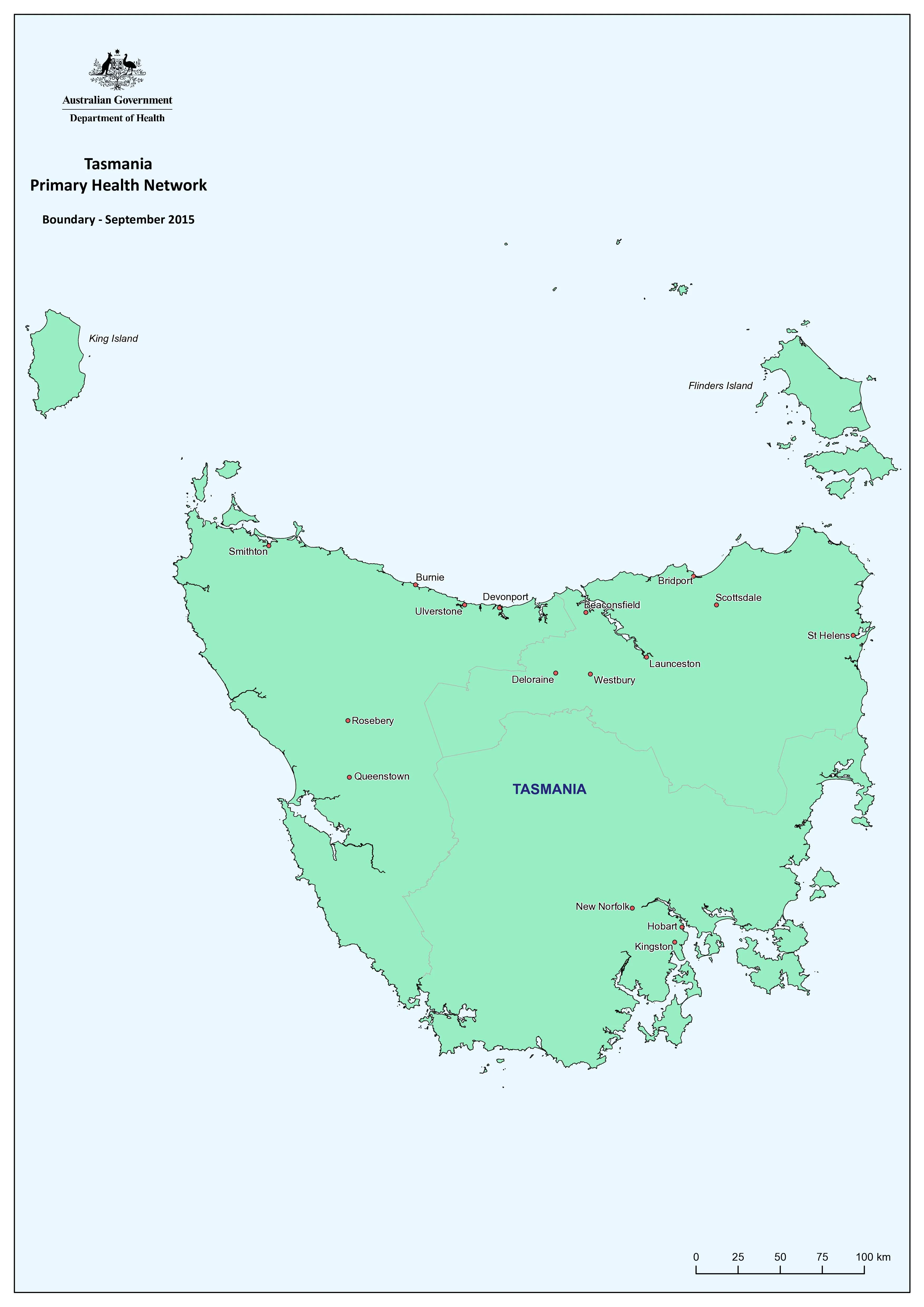
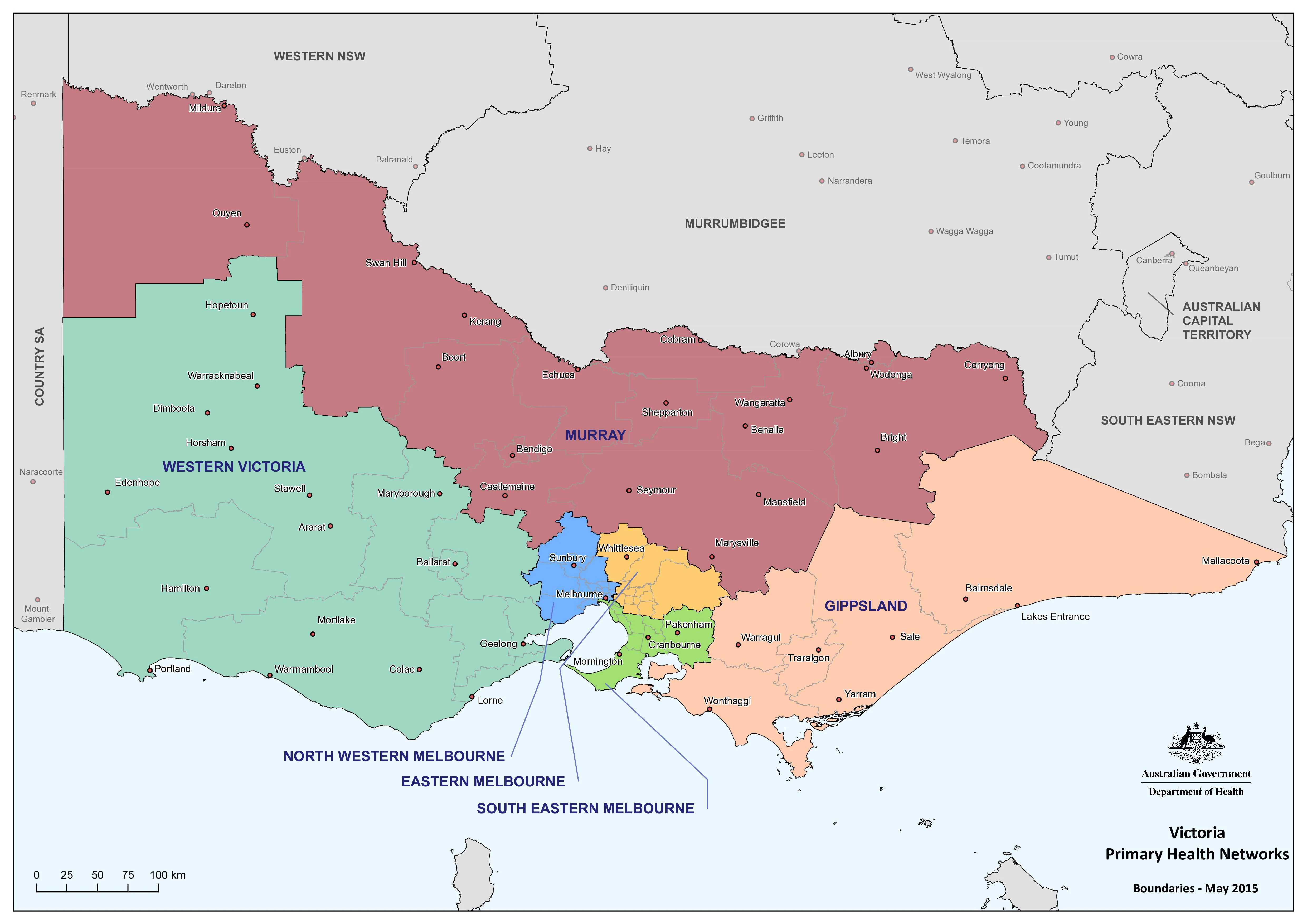
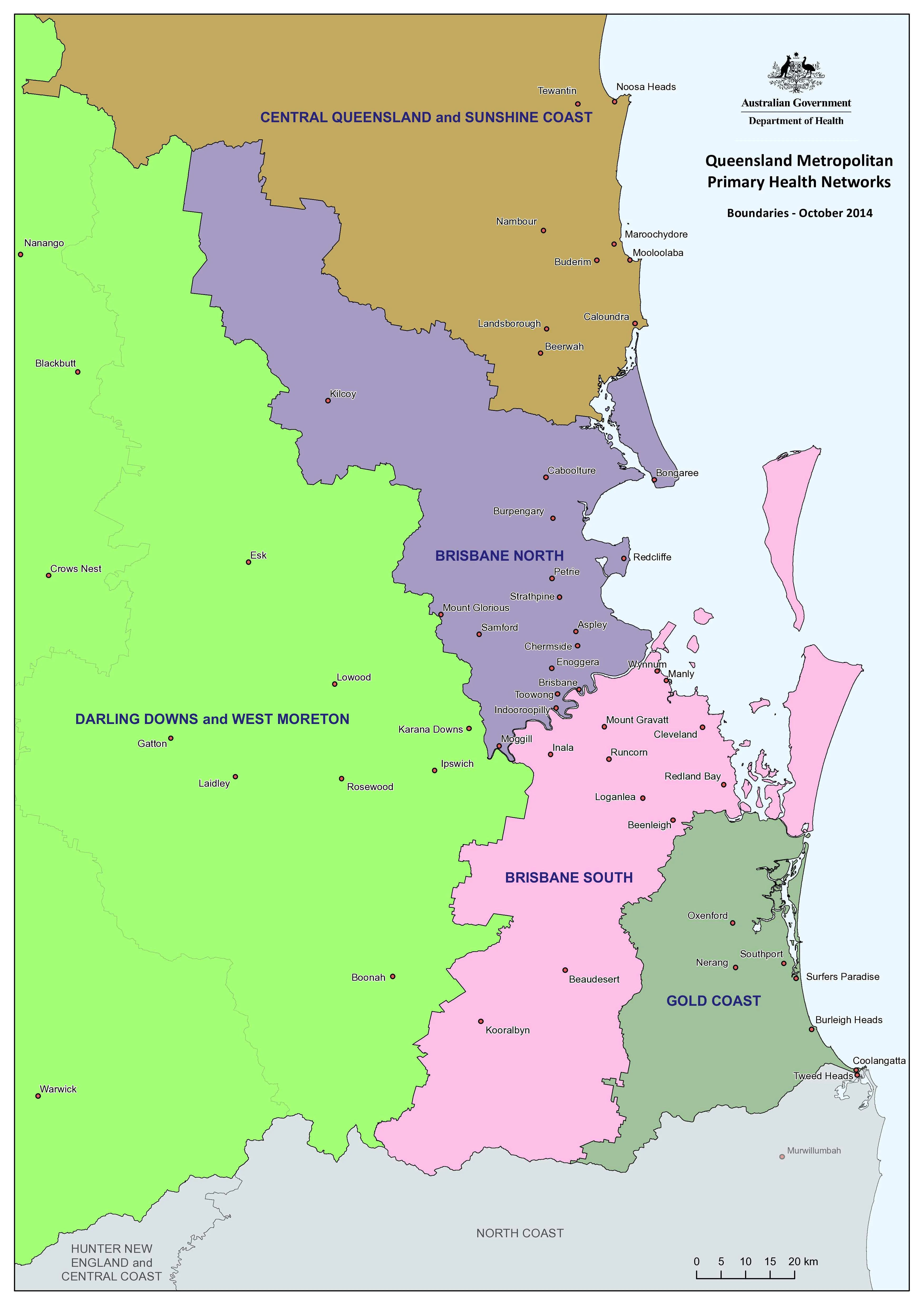
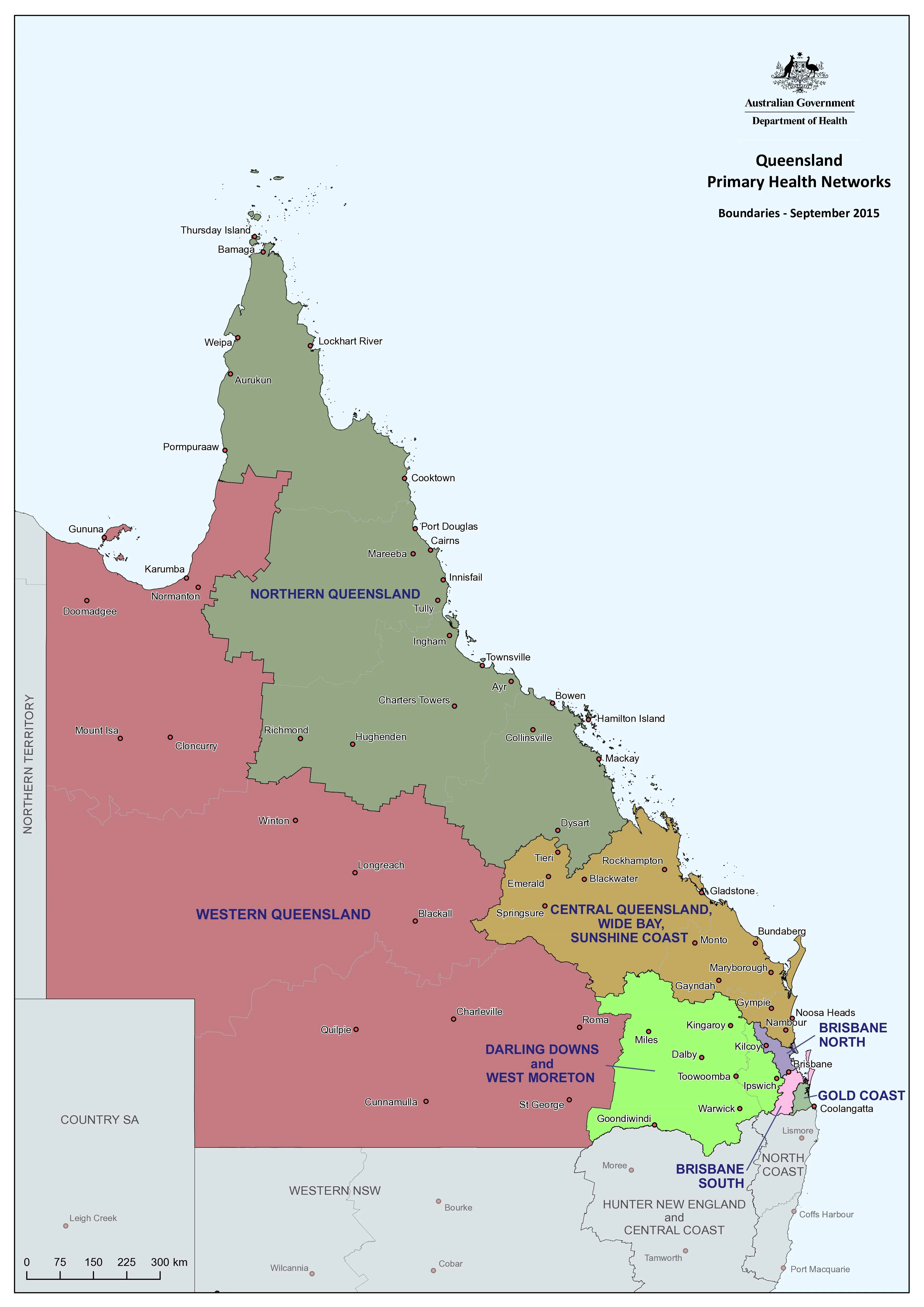
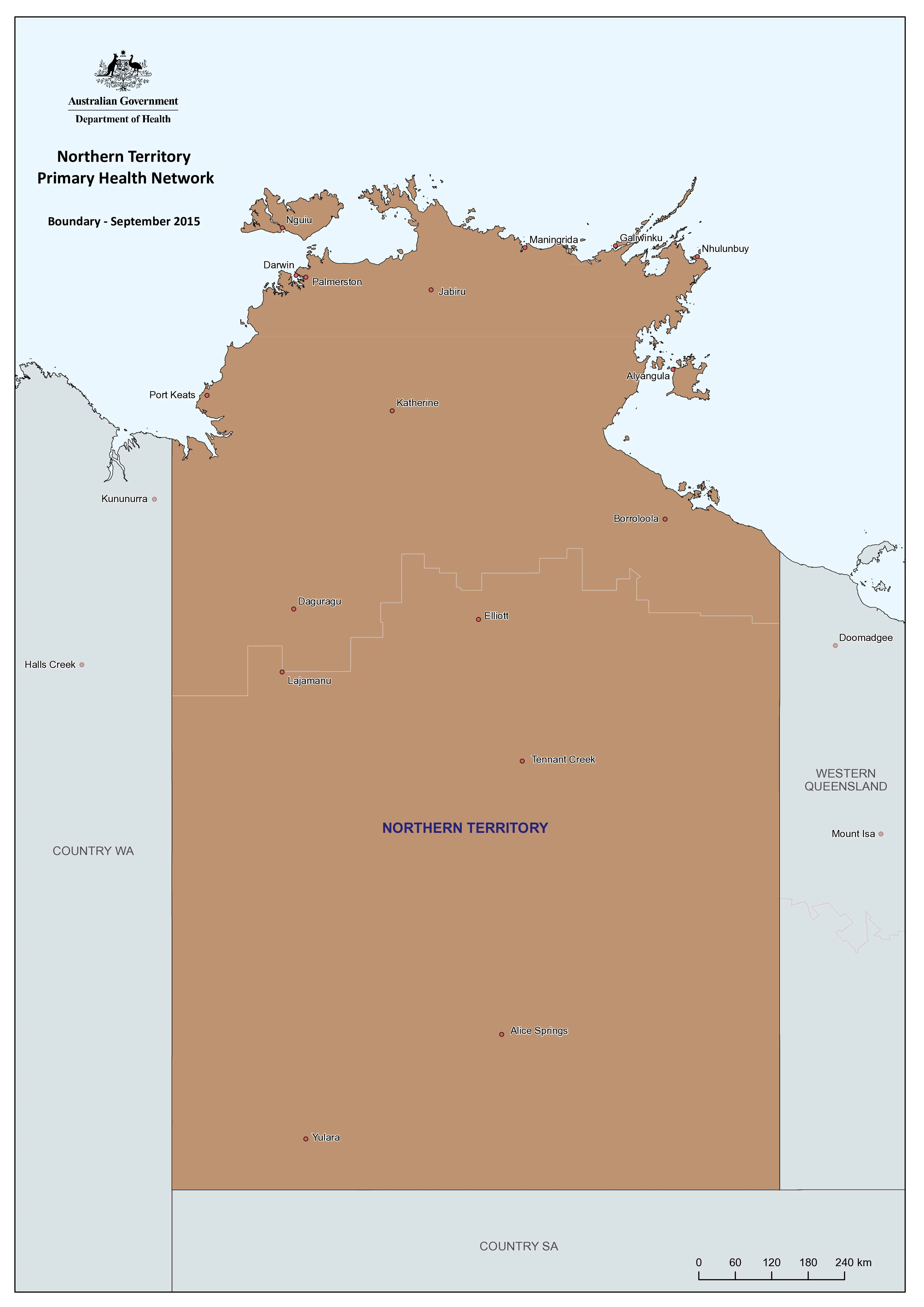
This large-format wall map presents NSW’s PHN regions with crisp boundary delineation, major place names, and geographic context. It transforms administrative divisions into a practical visual reference for health planning, commissioning, reporting, and coordination across metropolitan, regional, and rural New South Wales.
Updated for 2026, this edition reflects the current PHN structure used nationally for primary care commissioning and integration.
🏥 Understanding Primary Health Networks
Primary Health Networks deliver three core functions:
-
Coordinate and integrate local healthcare services with hospitals and providers
-
Commission primary care and mental health services to address regional needs
-
Support and strengthen providers to improve quality and equity of care
This map makes those boundaries visible — essential for strategic alignment and informed decision-making.
🧭 Why This Map Matters
-
Instant geographic insight — PHN regions clearly defined at a glance
-
Strategic planning tool — ideal for funding discussions, program delivery, and reporting
-
Supports collaboration — clarifies jurisdictional responsibilities quickly
-
Wall-scale readability — designed for shared professional environments
-
Professional presentation — suitable for boardrooms, offices, and training rooms
📐 Size & Orientation
-
1000 mm (W) × 707 mm (H)
-
Landscape orientation
-
Optimised for meeting rooms, planning walls, and collaborative workspaces
The horizontal format enhances readability across densely populated metropolitan corridors while maintaining statewide clarity.
✨ Premium Print & Display Options
All maps are printed in Australia using archival materials and professional production standards.
📄 Paper — 160 gsm Matte
-
Frame-ready with reduced glare
-
Crisp detail and accurate colour reproduction
-
Ideal for offices and formal display
💧 Laminated — True Encapsulation (2 × 80-micron gloss)
-
Fully sealed and edge-protected
-
Waterproof, tear-resistant, wipe-clean
-
Suitable for whiteboard markers and planning dots
🪵 Laminated + Timber Hang Rails
-
Laminated print fitted with natural timber rails (top & bottom)
-
Supplied with hanging cord
-
Please allow up to 10 working days for rail fitting
🎨 Archival Canvas — 395 gsm HP Professional Matte
-
Gallery-grade canvas with pigment-based inks
-
Non-glare, refined presentation
-
Long-term fade resistance
🪵 Canvas + Timber Hang Rails
-
Premium ready-to-hang display finish
-
Natural lacquered timber rails
-
Please allow up to 10 working days for completion
👥 Who It’s For
-
Primary Health Networks & Local Health District offices
-
Hospitals and health administration teams
-
Government departments & policy units
-
Universities & training providers
-
Public health researchers & analysts
-
Community health organisations & NGOs
🤝 Our Commitment
Every wall map is produced with professional users in mind.
-
Printed locally in Australia for quality control and dependable turnaround
-
Archival pigment inks for long-term colour stability
-
Precision colour management for accurate boundary reproduction
-
Carefully checked and packed for safe delivery
We supply wall maps trusted by health services, government agencies, and educators nationwide — because clear geographic understanding supports better health system decisions.
🛒 Bring NSW’s Primary Health Network structure into focus — choose your finish and order the 2026 Edition today.
Original: $50.05
-65%$50.05
$17.52Product Information
Product Information
Shipping & Returns
Shipping & Returns
Description
New South Wales — Primary Health Networks Wall Map (2026 Edition)
A clear, authoritative wall map of New South Wales’ Primary Health Network (PHN) boundaries — 2026 Edition, designed for planners, clinicians, administrators, and educators who need immediate geographic clarity.
This large-format wall map presents NSW’s PHN regions with crisp boundary delineation, major place names, and geographic context. It transforms administrative divisions into a practical visual reference for health planning, commissioning, reporting, and coordination across metropolitan, regional, and rural New South Wales.
Updated for 2026, this edition reflects the current PHN structure used nationally for primary care commissioning and integration.
🏥 Understanding Primary Health Networks
Primary Health Networks deliver three core functions:
-
Coordinate and integrate local healthcare services with hospitals and providers
-
Commission primary care and mental health services to address regional needs
-
Support and strengthen providers to improve quality and equity of care
This map makes those boundaries visible — essential for strategic alignment and informed decision-making.
🧭 Why This Map Matters
-
Instant geographic insight — PHN regions clearly defined at a glance
-
Strategic planning tool — ideal for funding discussions, program delivery, and reporting
-
Supports collaboration — clarifies jurisdictional responsibilities quickly
-
Wall-scale readability — designed for shared professional environments
-
Professional presentation — suitable for boardrooms, offices, and training rooms
📐 Size & Orientation
-
1000 mm (W) × 707 mm (H)
-
Landscape orientation
-
Optimised for meeting rooms, planning walls, and collaborative workspaces
The horizontal format enhances readability across densely populated metropolitan corridors while maintaining statewide clarity.
✨ Premium Print & Display Options
All maps are printed in Australia using archival materials and professional production standards.
📄 Paper — 160 gsm Matte
-
Frame-ready with reduced glare
-
Crisp detail and accurate colour reproduction
-
Ideal for offices and formal display
💧 Laminated — True Encapsulation (2 × 80-micron gloss)
-
Fully sealed and edge-protected
-
Waterproof, tear-resistant, wipe-clean
-
Suitable for whiteboard markers and planning dots
🪵 Laminated + Timber Hang Rails
-
Laminated print fitted with natural timber rails (top & bottom)
-
Supplied with hanging cord
-
Please allow up to 10 working days for rail fitting
🎨 Archival Canvas — 395 gsm HP Professional Matte
-
Gallery-grade canvas with pigment-based inks
-
Non-glare, refined presentation
-
Long-term fade resistance
🪵 Canvas + Timber Hang Rails
-
Premium ready-to-hang display finish
-
Natural lacquered timber rails
-
Please allow up to 10 working days for completion
👥 Who It’s For
-
Primary Health Networks & Local Health District offices
-
Hospitals and health administration teams
-
Government departments & policy units
-
Universities & training providers
-
Public health researchers & analysts
-
Community health organisations & NGOs
🤝 Our Commitment
Every wall map is produced with professional users in mind.
-
Printed locally in Australia for quality control and dependable turnaround
-
Archival pigment inks for long-term colour stability
-
Precision colour management for accurate boundary reproduction
-
Carefully checked and packed for safe delivery
We supply wall maps trusted by health services, government agencies, and educators nationwide — because clear geographic understanding supports better health system decisions.
🛒 Bring NSW’s Primary Health Network structure into focus — choose your finish and order the 2026 Edition today.