Victoria State Electoral Divisions Map - State
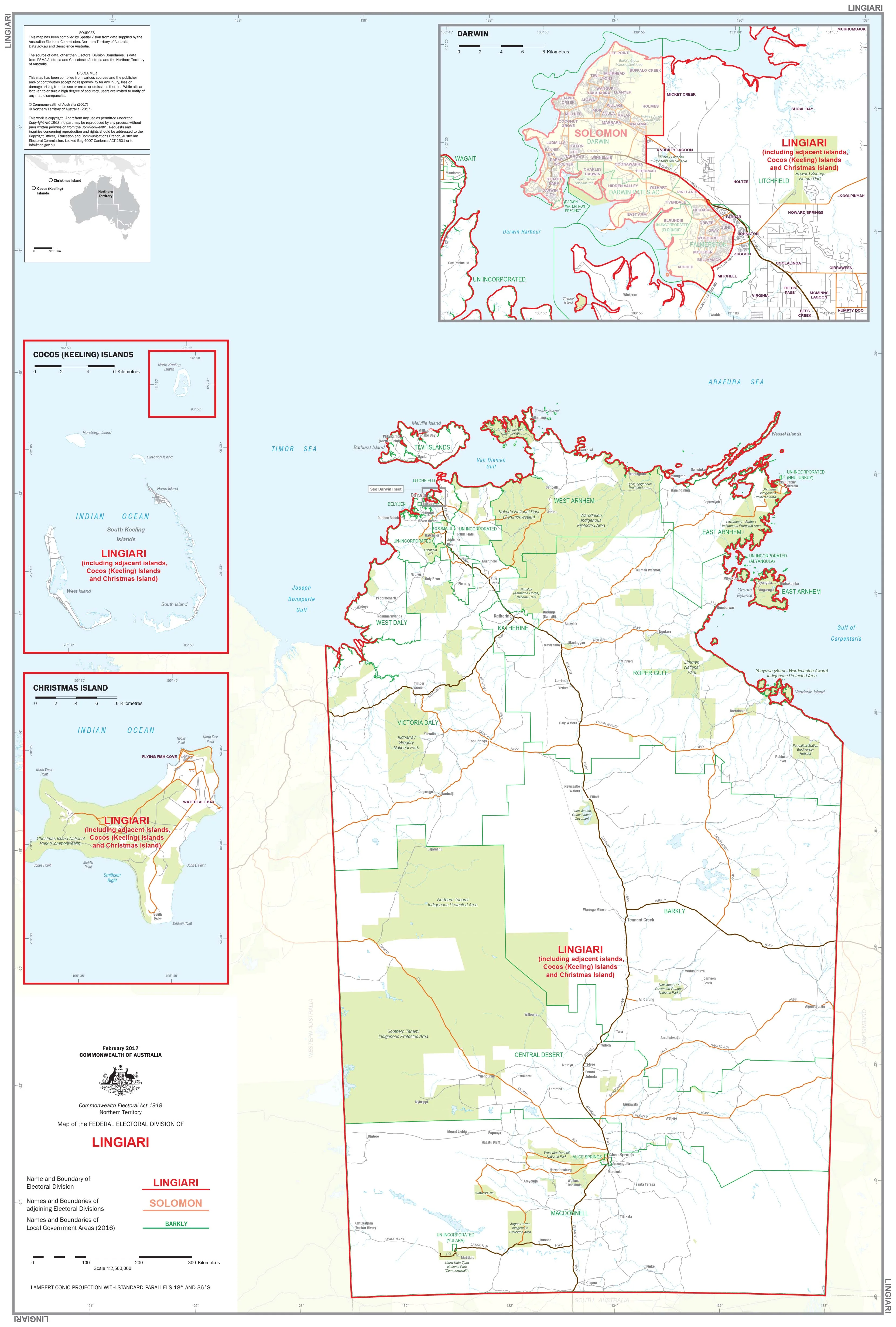
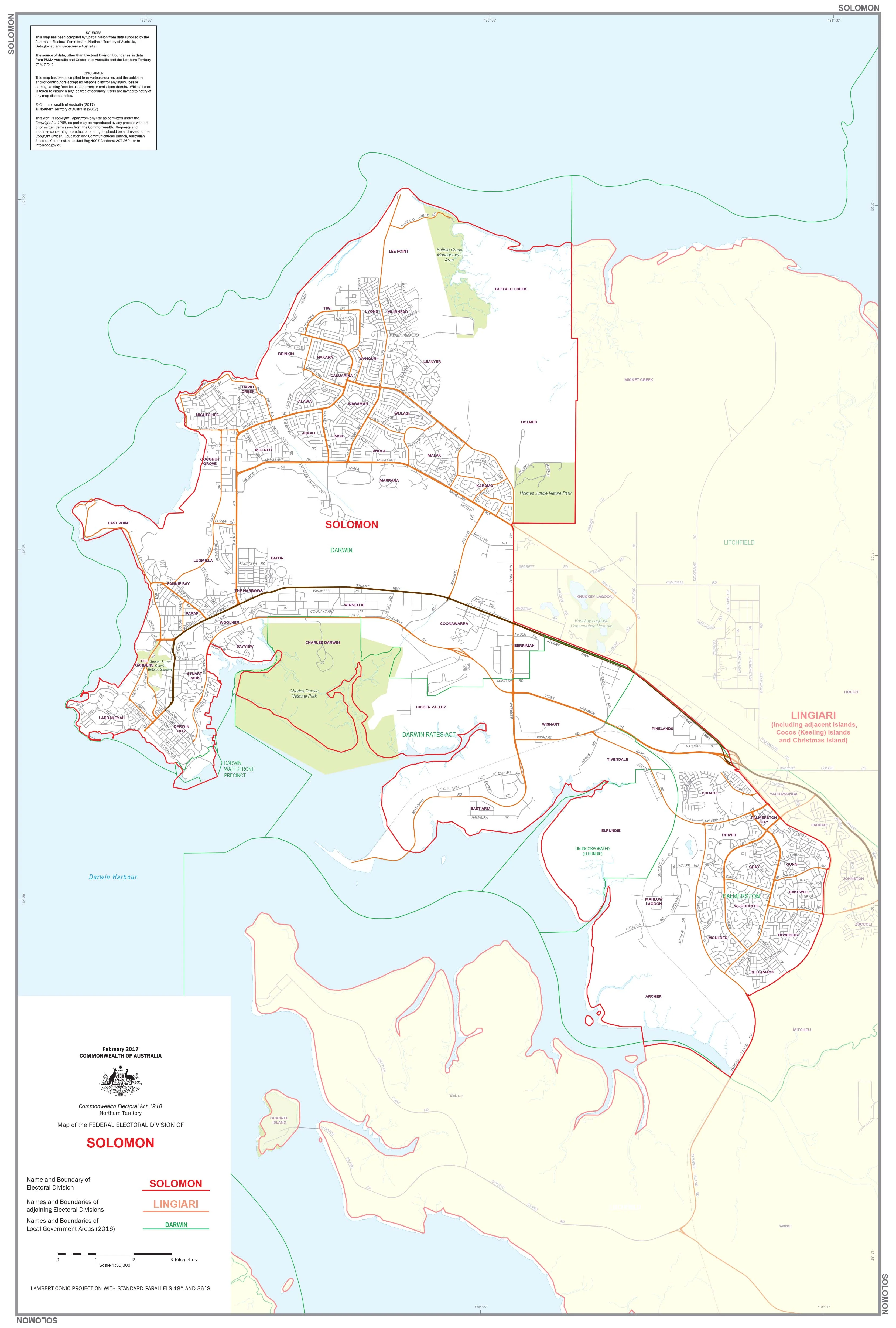
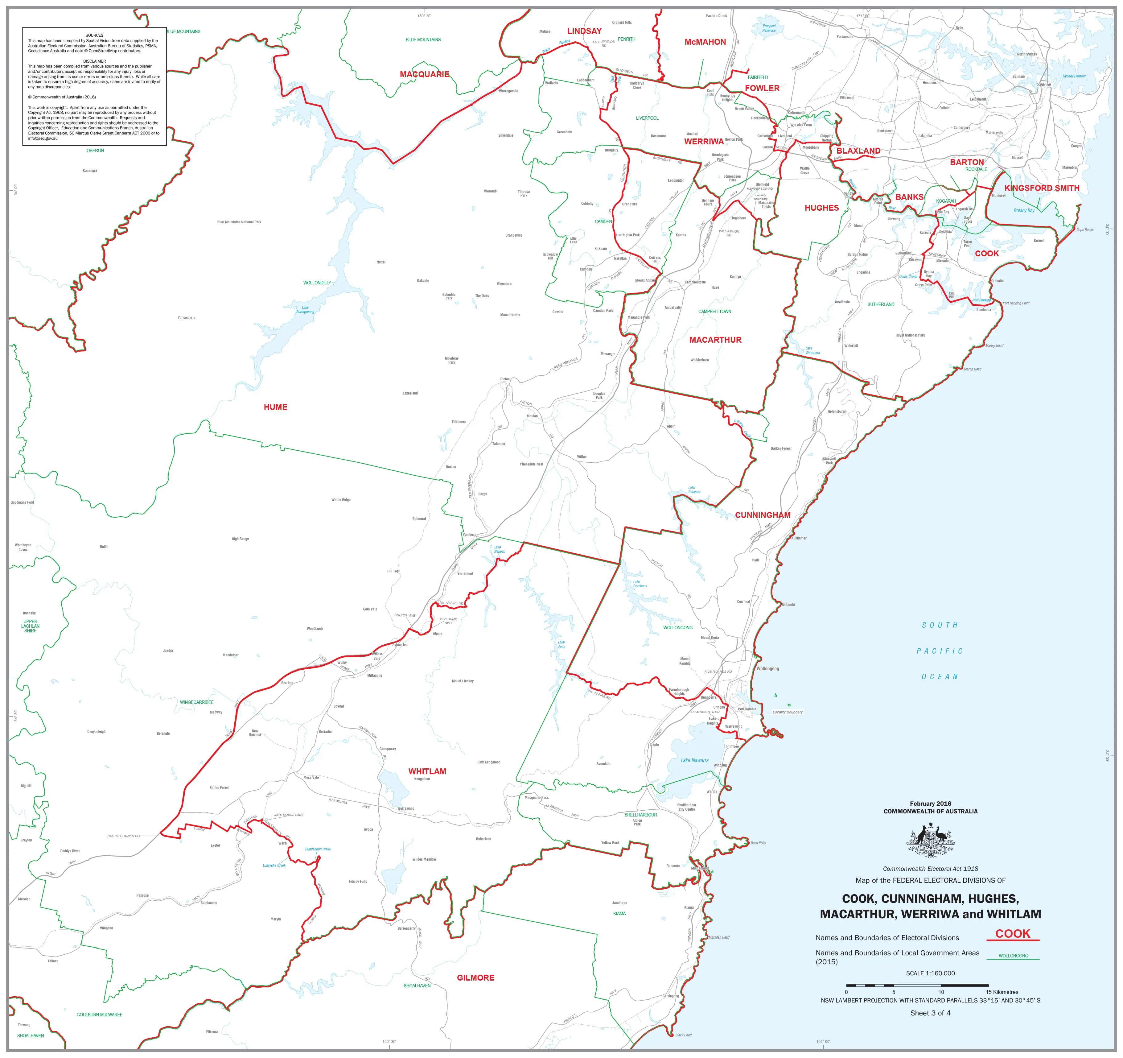
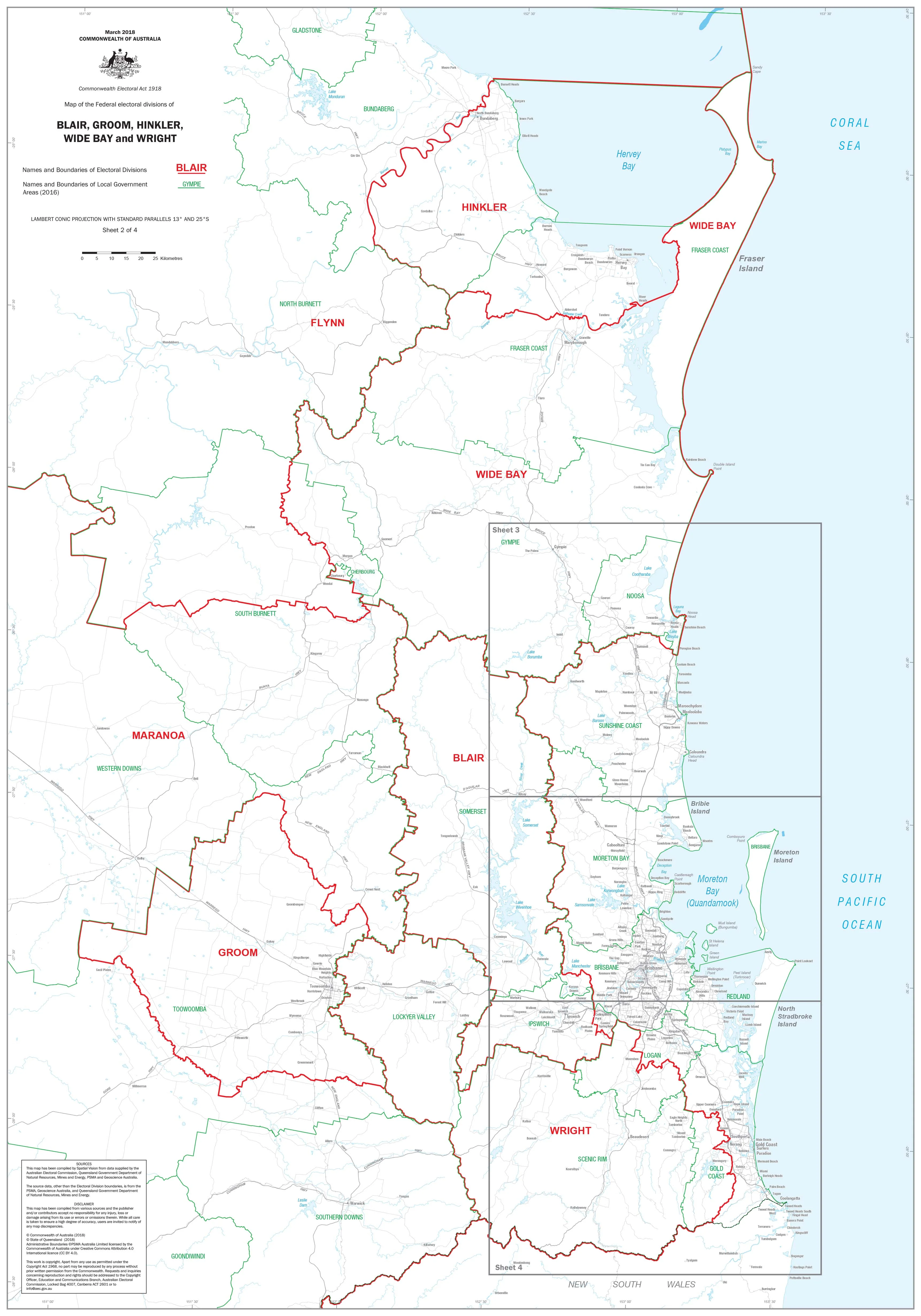
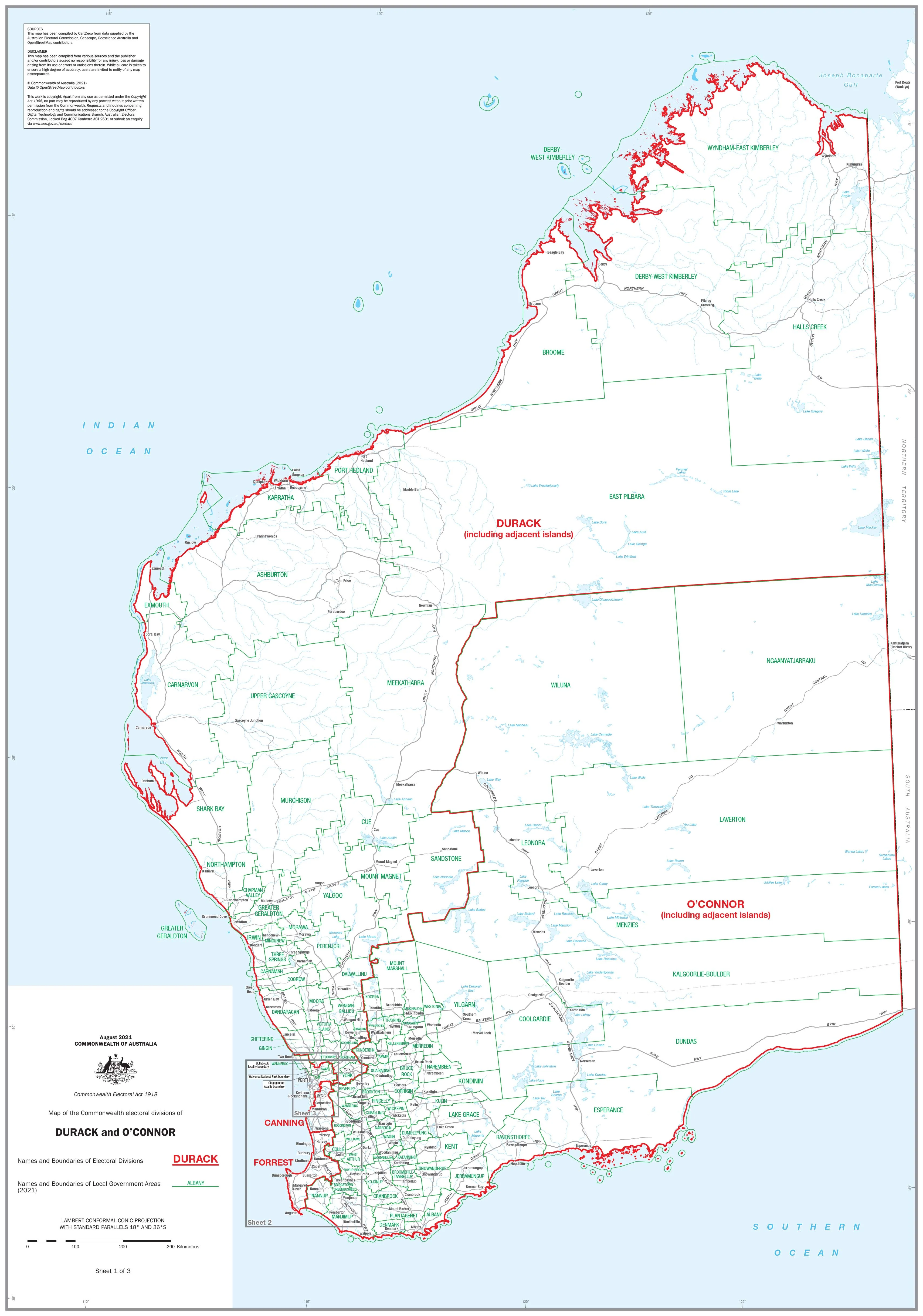
Victoria — State Electoral Divisions (Official Boundaries)
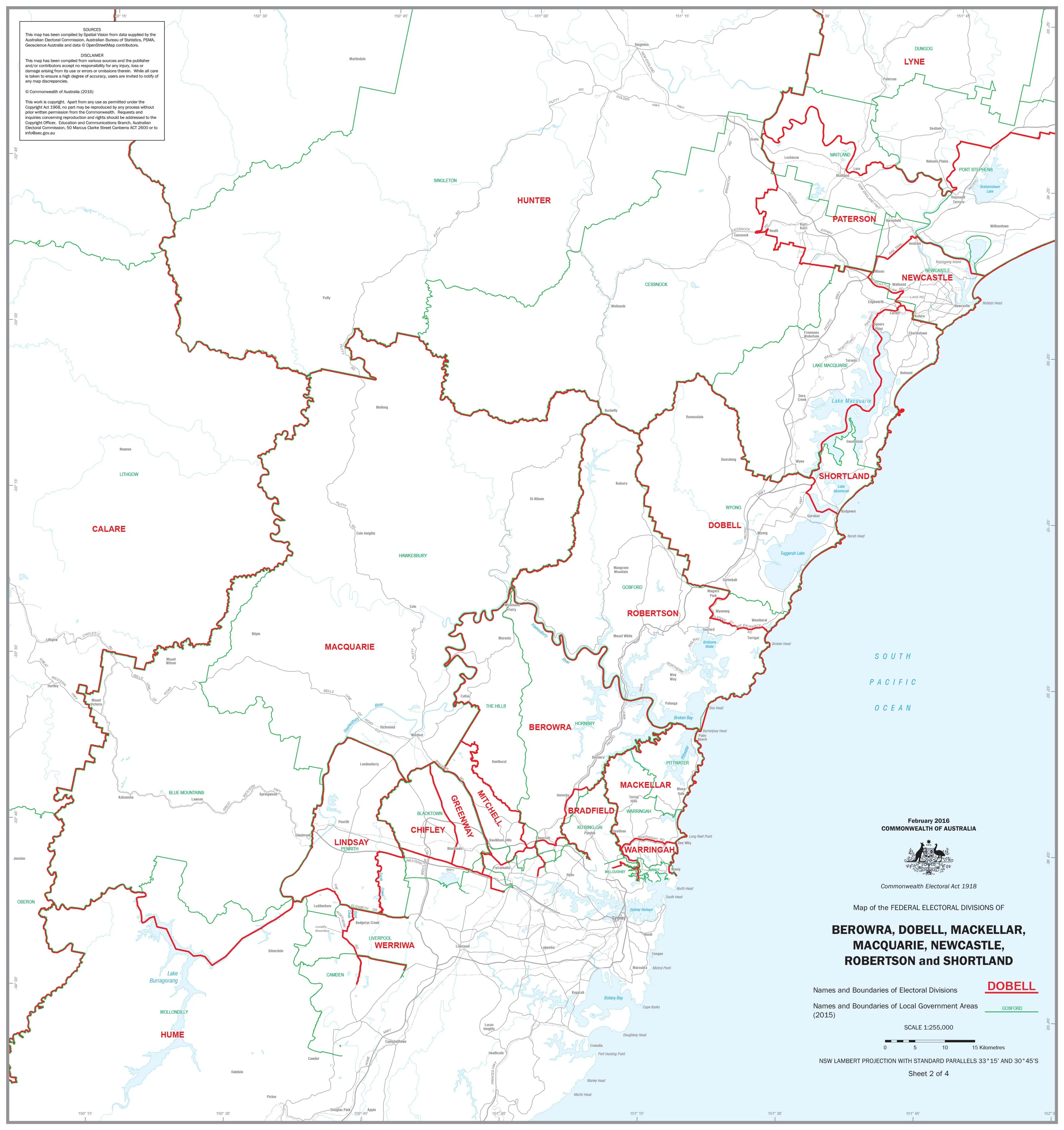
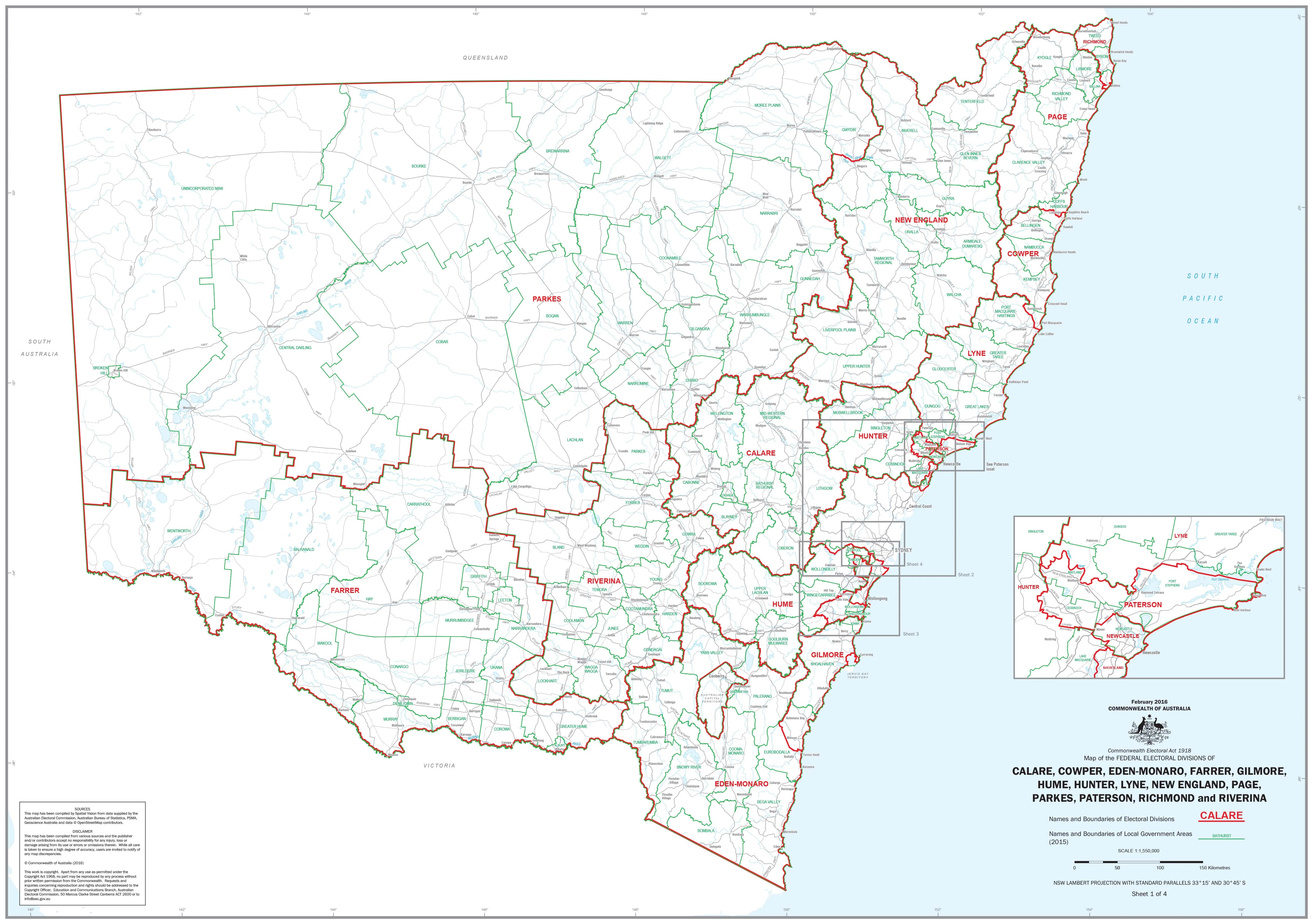
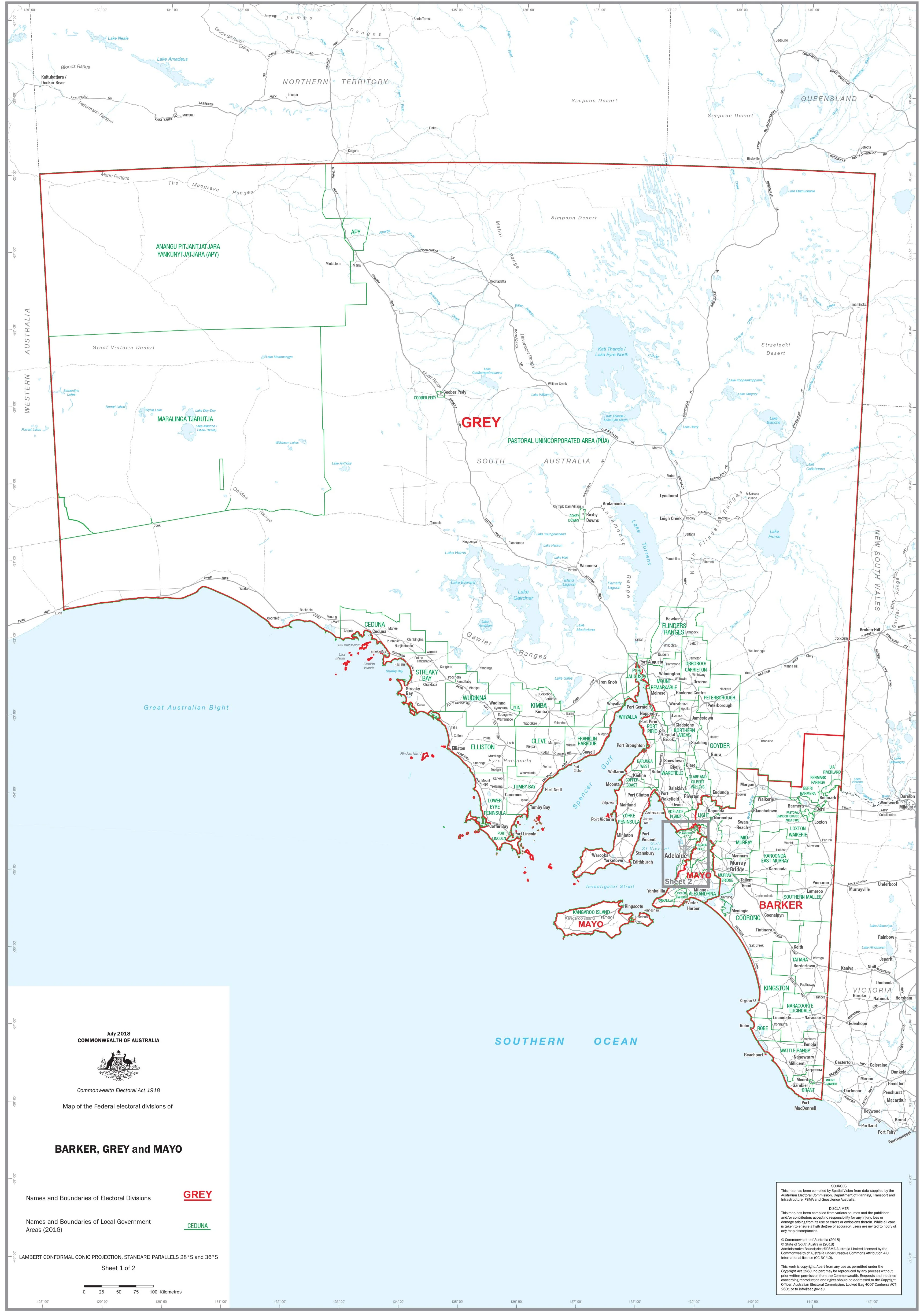
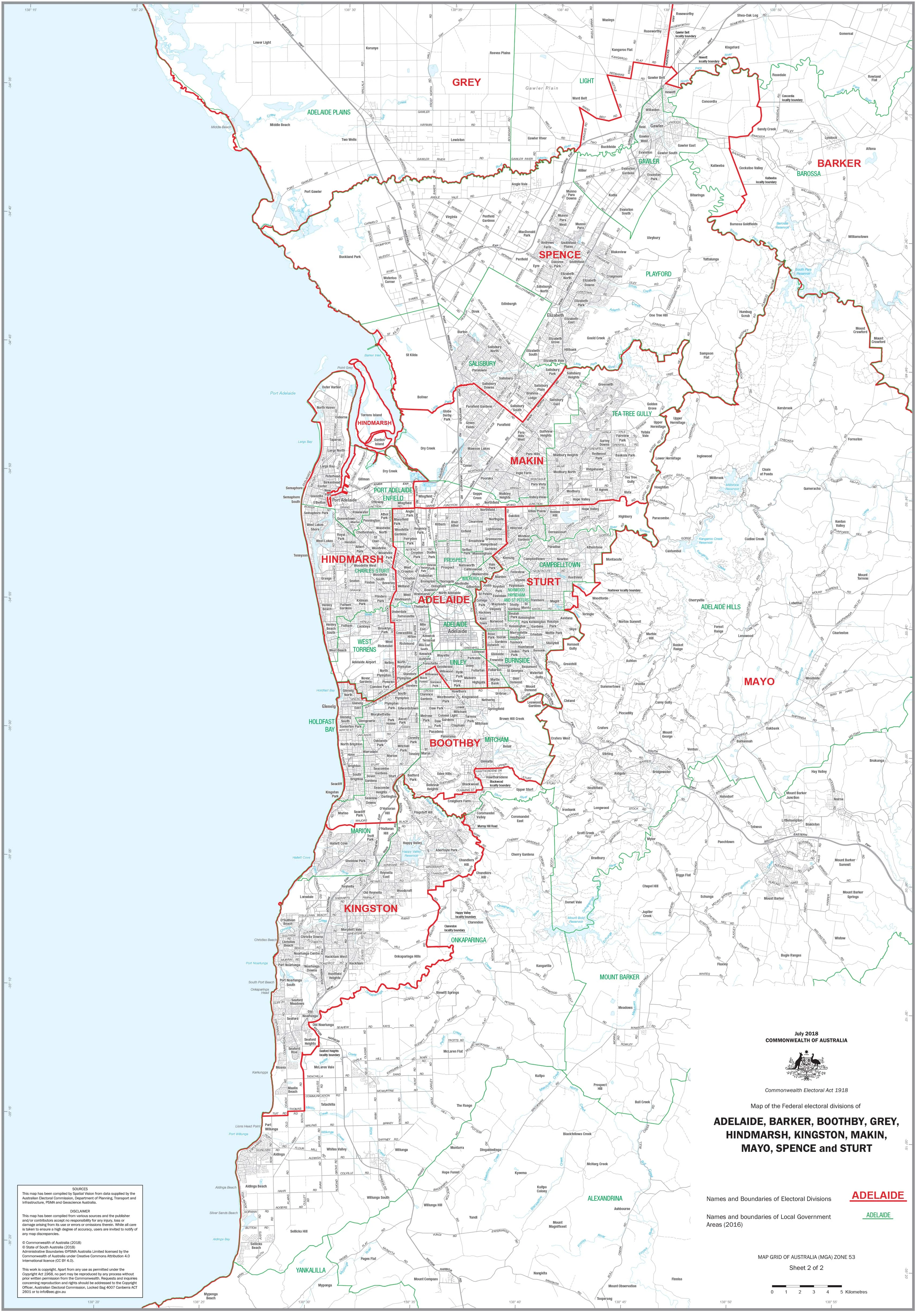
A clear, authoritative overview of Victoria’s state electoral landscape. This map presents official division boundaries and names in a clean, wall-readable design—ideal for education, government, business, libraries, and public display.
🔍 At a Glance (What’s on the Map)
-
🗺️ Official boundaries: All current Victorian state electoral divisions delineated with precision
-
🏷️ Division labels: Every electorate clearly named for rapid reference
-
🧭 Metropolitan & regional clarity: Balanced view of Melbourne metro and regional Victoria
-
👁️ Wall-readable design: Calm palette, tuned line weights, and crisp typography
-
📏 Legend & scale: Simple, intuitive symbology for quick interpretation
Clean symbology and a tuned legend make complex boundaries instantly legible—even from across the room.
Why This Map Works
-
Wall clarity: Hierarchies, line weights, and labels optimised for distance viewing
-
Planning-ready: Perfect for outreach, service delivery, booth planning, and stakeholder briefings
-
Teaching tool: A dependable visual aid for civics, geography, and electoral studies
-
Professional finish: Elegant enough for boardrooms; robust for classrooms and public spaces
🎨 Finishes & Display Options
-
📄 Paper (Heavyweight 160 gsm)
-
Smooth, sturdy matte stock—perfect for framing under glass with low glare and crisp detail.
-
-
💧 Laminated (True Encapsulation)
-
Encased in 2 × 80-micron gloss laminate, edge-sealed.
-
Waterproof • Tear-resistant • Wipe-clean (whiteboard-marker and map-dot friendly).
-
-
🪵 Laminated + Timber Hang Rails (Ready to Hang)
-
Laminated map with natural lacquered timber rails (top & bottom) and a top hanging cord.
-
⏱️ Custom finish: allow up to 10 working days for rail fitting.
-
-
🖼️ Canvas (HP 395 gsm Professional Matte)
-
Printed with HP archival pigment inks for sharp, fade-resistant colour.
-
Gallery-grade, non-glare presentation suited to executive and public spaces.
-
-
🪵 Canvas + Timber Hang Rails
-
Same canvas with lacquered timber rails (top & bottom) + top hanging cord — ready to hang.
-
⏱️ Custom finish: allow up to 10 working days for rail fitting.
-
🧭 How Teams Use It
-
Government & councils: Boundary awareness, service planning, consultation
-
Campaign & outreach: Volunteer coordination, booth planning, electorate briefings
-
Education & libraries: Teaching civics and geography with an easy wall reference
-
Businesses & NGOs: Territory planning, stakeholder mapping, community engagement
📐 Size
-
1000 mm (W) × 700 mm (H) • Portrait
📊 Specifications
| Attribute | Details |
|---|---|
| Title | Victoria — State Electoral Divisions (Official Boundaries) |
| Content | Official state electoral division names & boundaries |
| Formats | Paper • Laminated • Laminated + Timber Hang Rails • Canvas • Canvas + Timber Hang Rails |
| Paper (Unlaminated) | Heavyweight 160 gsm |
| Laminate | 2 × 80-micron gloss (true encapsulation) |
| Canvas | HP 395 gsm Professional Matte |
| Inks | HP archival pigment-based (fade-resistant) |
| Size | 1000 × 700 mm |
| Printed in | Australia |
🤝 Our Commitment
-
Local craftsmanship: Printed and finished in Australia with careful colour management
-
Archival quality: Pigment-based inks on premium stocks and canvas for long-lasting fidelity
-
Built to last: True-encapsulation lamination and 395 gsm canvas for daily display use
-
Clarity first: Legends, symbols, and labels tuned for wall readability
-
Flexible options: Custom sizes, branding, and individual division maps available on request
🛒 Add this essential electoral reference to your wall—functional, professional, and designed to be understood at a glance.
Product Information
Product Information
Shipping & Returns
Shipping & Returns
Description
Victoria — State Electoral Divisions (Official Boundaries)
A clear, authoritative overview of Victoria’s state electoral landscape. This map presents official division boundaries and names in a clean, wall-readable design—ideal for education, government, business, libraries, and public display.
🔍 At a Glance (What’s on the Map)
-
🗺️ Official boundaries: All current Victorian state electoral divisions delineated with precision
-
🏷️ Division labels: Every electorate clearly named for rapid reference
-
🧭 Metropolitan & regional clarity: Balanced view of Melbourne metro and regional Victoria
-
👁️ Wall-readable design: Calm palette, tuned line weights, and crisp typography
-
📏 Legend & scale: Simple, intuitive symbology for quick interpretation
Clean symbology and a tuned legend make complex boundaries instantly legible—even from across the room.
Why This Map Works
-
Wall clarity: Hierarchies, line weights, and labels optimised for distance viewing
-
Planning-ready: Perfect for outreach, service delivery, booth planning, and stakeholder briefings
-
Teaching tool: A dependable visual aid for civics, geography, and electoral studies
-
Professional finish: Elegant enough for boardrooms; robust for classrooms and public spaces
🎨 Finishes & Display Options
-
📄 Paper (Heavyweight 160 gsm)
-
Smooth, sturdy matte stock—perfect for framing under glass with low glare and crisp detail.
-
-
💧 Laminated (True Encapsulation)
-
Encased in 2 × 80-micron gloss laminate, edge-sealed.
-
Waterproof • Tear-resistant • Wipe-clean (whiteboard-marker and map-dot friendly).
-
-
🪵 Laminated + Timber Hang Rails (Ready to Hang)
-
Laminated map with natural lacquered timber rails (top & bottom) and a top hanging cord.
-
⏱️ Custom finish: allow up to 10 working days for rail fitting.
-
-
🖼️ Canvas (HP 395 gsm Professional Matte)
-
Printed with HP archival pigment inks for sharp, fade-resistant colour.
-
Gallery-grade, non-glare presentation suited to executive and public spaces.
-
-
🪵 Canvas + Timber Hang Rails
-
Same canvas with lacquered timber rails (top & bottom) + top hanging cord — ready to hang.
-
⏱️ Custom finish: allow up to 10 working days for rail fitting.
-
🧭 How Teams Use It
-
Government & councils: Boundary awareness, service planning, consultation
-
Campaign & outreach: Volunteer coordination, booth planning, electorate briefings
-
Education & libraries: Teaching civics and geography with an easy wall reference
-
Businesses & NGOs: Territory planning, stakeholder mapping, community engagement
📐 Size
-
1000 mm (W) × 700 mm (H) • Portrait
📊 Specifications
| Attribute | Details |
|---|---|
| Title | Victoria — State Electoral Divisions (Official Boundaries) |
| Content | Official state electoral division names & boundaries |
| Formats | Paper • Laminated • Laminated + Timber Hang Rails • Canvas • Canvas + Timber Hang Rails |
| Paper (Unlaminated) | Heavyweight 160 gsm |
| Laminate | 2 × 80-micron gloss (true encapsulation) |
| Canvas | HP 395 gsm Professional Matte |
| Inks | HP archival pigment-based (fade-resistant) |
| Size | 1000 × 700 mm |
| Printed in | Australia |
🤝 Our Commitment
-
Local craftsmanship: Printed and finished in Australia with careful colour management
-
Archival quality: Pigment-based inks on premium stocks and canvas for long-lasting fidelity
-
Built to last: True-encapsulation lamination and 395 gsm canvas for daily display use
-
Clarity first: Legends, symbols, and labels tuned for wall readability
-
Flexible options: Custom sizes, branding, and individual division maps available on request
🛒 Add this essential electoral reference to your wall—functional, professional, and designed to be understood at a glance.