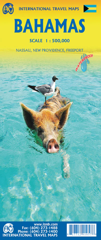
Antigua & St Kitts Nevis ITMB Map
Double-Sided | Detailed Caribbean Island Mapping | Includes Barbuda Inset
Size: 990 mm x 680 mm | Folded Travel Map
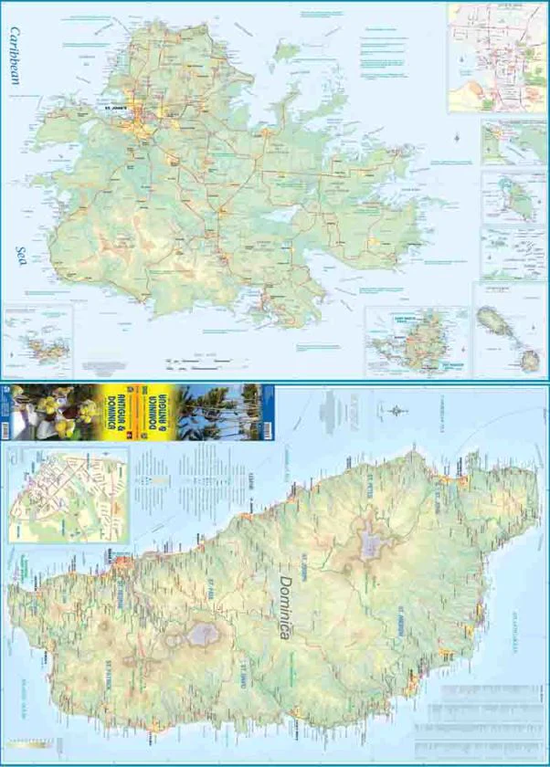
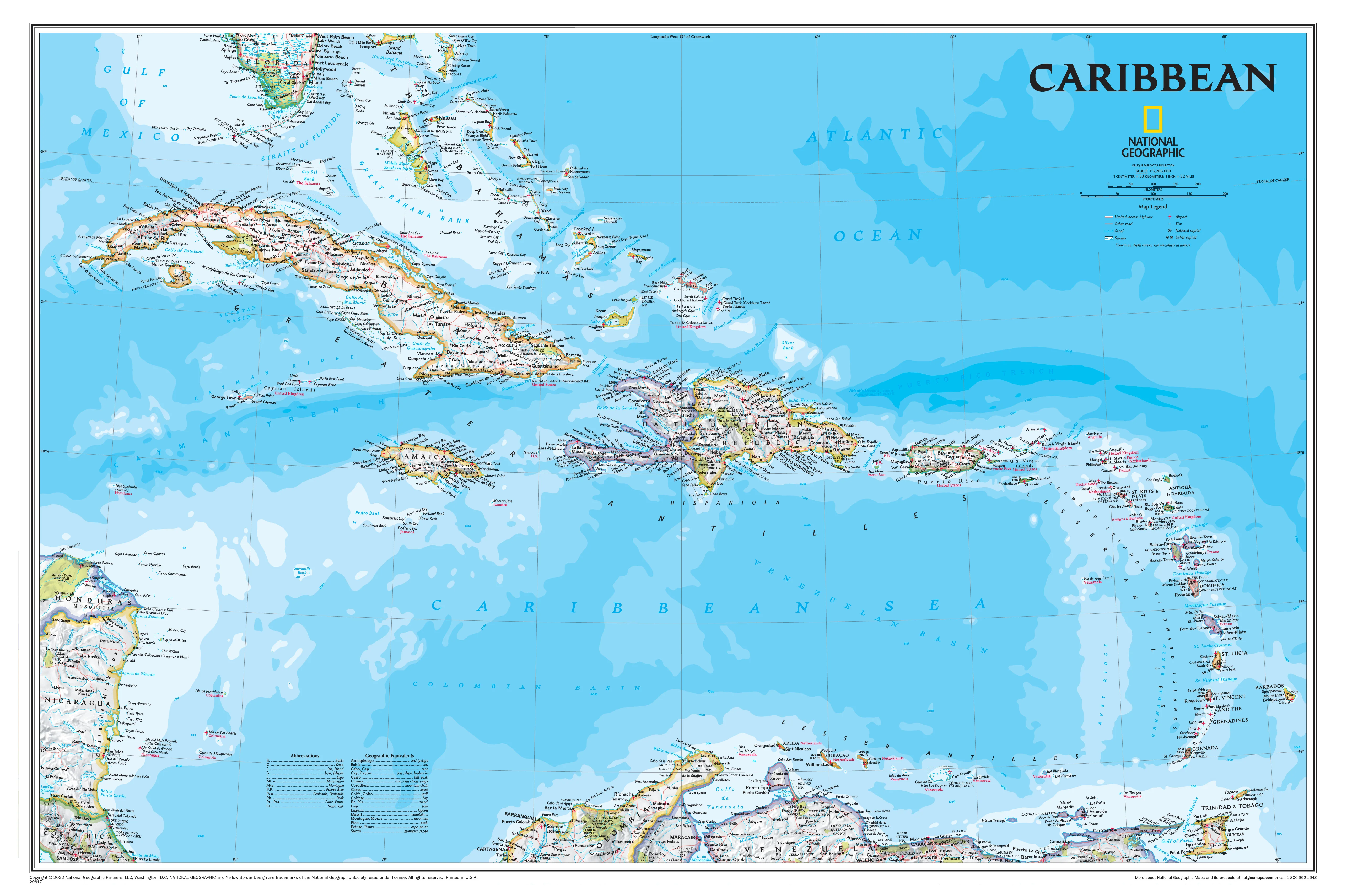
Discover the charm, history, and tropical beauty of the Eastern Caribbean with the Antigua & St. Kitts–Nevis Map by ITMB (International Travel Maps). This new combination edition offers detailed cartographic coverage of three island nations: Antigua, Barbuda, and the twin-island federation of St. Kitts and Nevis—perfect for travellers, sailors, or anyone exploring this vibrant part of the Caribbean.
🌴 What’s Included?
🔹 Side 1 – Antigua & Barbuda
-
Full island map of Antigua with updated detail
-
Inset map of St. John’s, the capital city
-
⚓ Features Nelson’s Dockyard at English Harbour—a historic British naval base
-
Inset of Barbuda, a quieter sister island with pristine beaches and coral reefs
🔹 Side 2 – St. Kitts & Nevis
-
Full coverage of both islands, showing:
-
Main roads and secondary routes
-
Coastal features and urban areas
-
Tourist highlights, beaches, ferry routes, and hiking areas
-
📌 Key Features
| Feature | Description |
|---|---|
| 🗺️ Updated Cartography | Latest edition with refreshed digital data |
| 🌊 Multi-Island Coverage | Covers Antigua, Barbuda, St. Kitts, and Nevis |
| 🏙️ City Inset | St. John’s detailed inset for street-level navigation |
| 🏰 Cultural Sites | Includes Nelson’s Dockyard and other points of interest |
| 🛣️ Road Network | Clearly marked roads, routes, and ferry terminals |
| 📐 Practical Format | Compact and foldable – ideal for pockets, backpacks, or carry-ons |
| 🌍 Tourist Focused | Great for planning beach trips, city visits, or eco-adventures |
📐 Product Specifications
| Specification | Detail |
|---|---|
| Title | Antigua & St. Kitts–Nevis Map |
| Publisher | ITMB – International Travel Maps |
| Format | Double-sided folded map |
| Size | 990 mm (W) x 680 mm (H) (unfolded) |
| Edition | Latest available |
| Paper Type | Durable, high-quality travel paper |
| Full colour with shaded relief |
🎯 Who Is This Map For?
-
🧭 Island-hopping travellers exploring the Lesser Antilles
-
🛥️ Cruise ship guests visiting multiple islands in one trip
-
🧳 Independent adventurers & backpackers
-
🏖️ Tourists planning beach, heritage, or eco-experiences
-
📚 Students & educators looking for accurate island reference maps
-
🗺️ Map collectors & Caribbean enthusiasts
🛒 Plan Your Caribbean Escape with Confidence
From the cultural vibrancy of St. John’s to the volcanic landscapes of Nevis and the peaceful sands of Barbuda, the Antigua & St. Kitts–Nevis Map by ITMB brings the islands to life—whether you're exploring by road, boat, or backpack.
📦 Lightweight, easy to fold, and packed with up-to-date information—your perfect island companion awaits.
Product Information
Product Information
Shipping & Returns
Shipping & Returns
Description
Double-Sided | Detailed Caribbean Island Mapping | Includes Barbuda Inset
Size: 990 mm x 680 mm | Folded Travel Map
Discover the charm, history, and tropical beauty of the Eastern Caribbean with the Antigua & St. Kitts–Nevis Map by ITMB (International Travel Maps). This new combination edition offers detailed cartographic coverage of three island nations: Antigua, Barbuda, and the twin-island federation of St. Kitts and Nevis—perfect for travellers, sailors, or anyone exploring this vibrant part of the Caribbean.
🌴 What’s Included?
🔹 Side 1 – Antigua & Barbuda
-
Full island map of Antigua with updated detail
-
Inset map of St. John’s, the capital city
-
⚓ Features Nelson’s Dockyard at English Harbour—a historic British naval base
-
Inset of Barbuda, a quieter sister island with pristine beaches and coral reefs
🔹 Side 2 – St. Kitts & Nevis
-
Full coverage of both islands, showing:
-
Main roads and secondary routes
-
Coastal features and urban areas
-
Tourist highlights, beaches, ferry routes, and hiking areas
-
📌 Key Features
| Feature | Description |
|---|---|
| 🗺️ Updated Cartography | Latest edition with refreshed digital data |
| 🌊 Multi-Island Coverage | Covers Antigua, Barbuda, St. Kitts, and Nevis |
| 🏙️ City Inset | St. John’s detailed inset for street-level navigation |
| 🏰 Cultural Sites | Includes Nelson’s Dockyard and other points of interest |
| 🛣️ Road Network | Clearly marked roads, routes, and ferry terminals |
| 📐 Practical Format | Compact and foldable – ideal for pockets, backpacks, or carry-ons |
| 🌍 Tourist Focused | Great for planning beach trips, city visits, or eco-adventures |
📐 Product Specifications
| Specification | Detail |
|---|---|
| Title | Antigua & St. Kitts–Nevis Map |
| Publisher | ITMB – International Travel Maps |
| Format | Double-sided folded map |
| Size | 990 mm (W) x 680 mm (H) (unfolded) |
| Edition | Latest available |
| Paper Type | Durable, high-quality travel paper |
| Full colour with shaded relief |
🎯 Who Is This Map For?
-
🧭 Island-hopping travellers exploring the Lesser Antilles
-
🛥️ Cruise ship guests visiting multiple islands in one trip
-
🧳 Independent adventurers & backpackers
-
🏖️ Tourists planning beach, heritage, or eco-experiences
-
📚 Students & educators looking for accurate island reference maps
-
🗺️ Map collectors & Caribbean enthusiasts
🛒 Plan Your Caribbean Escape with Confidence
From the cultural vibrancy of St. John’s to the volcanic landscapes of Nevis and the peaceful sands of Barbuda, the Antigua & St. Kitts–Nevis Map by ITMB brings the islands to life—whether you're exploring by road, boat, or backpack.
📦 Lightweight, easy to fold, and packed with up-to-date information—your perfect island companion awaits.