Islands of the Antilles - Atlas of the World, 11th Edition by National Geographic
Inset Map Collection | Caribbean Islands in Detail | Atlas of the World, 11th Edition (798 × 610 mm) | Premium Finishes
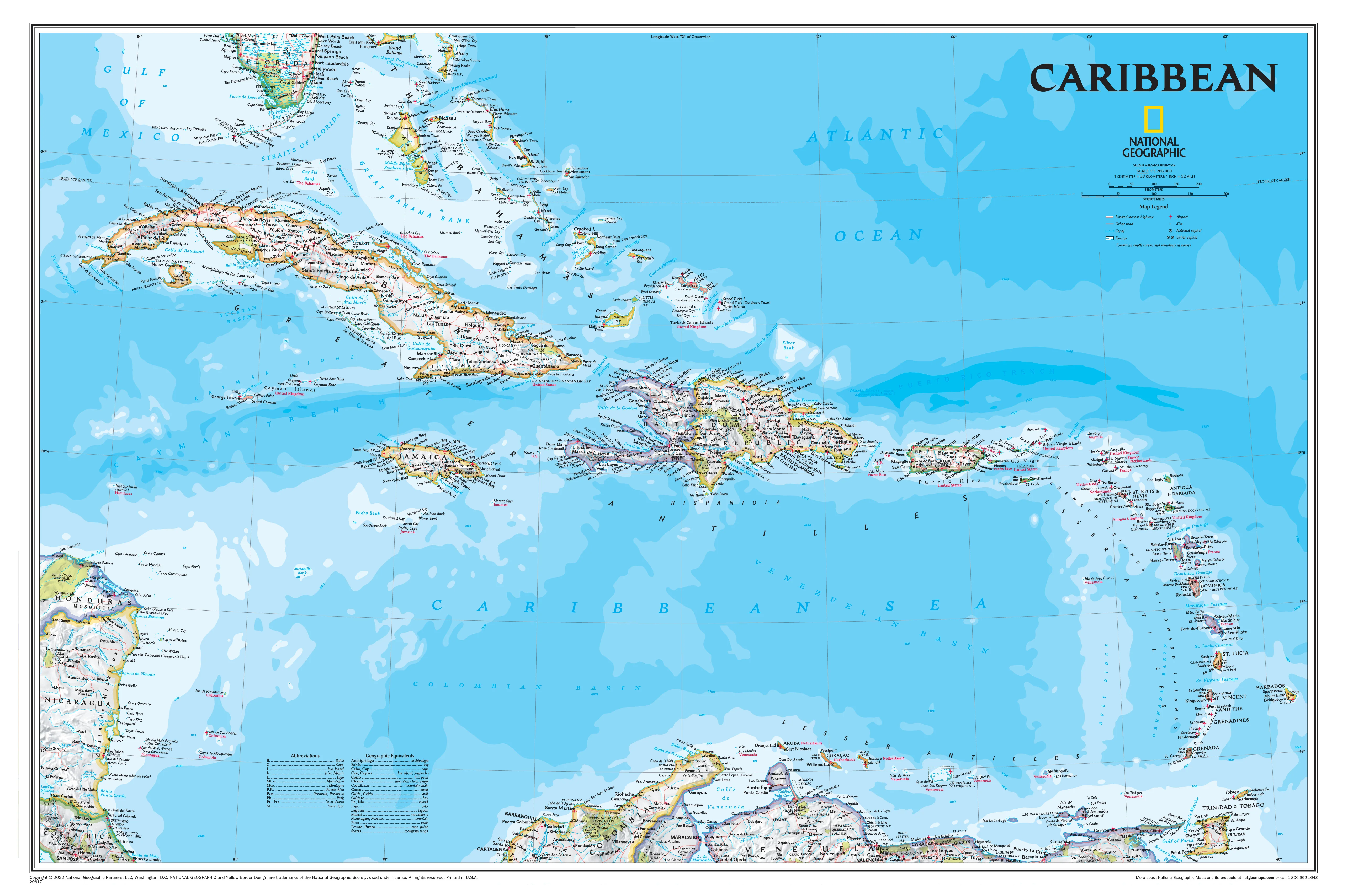
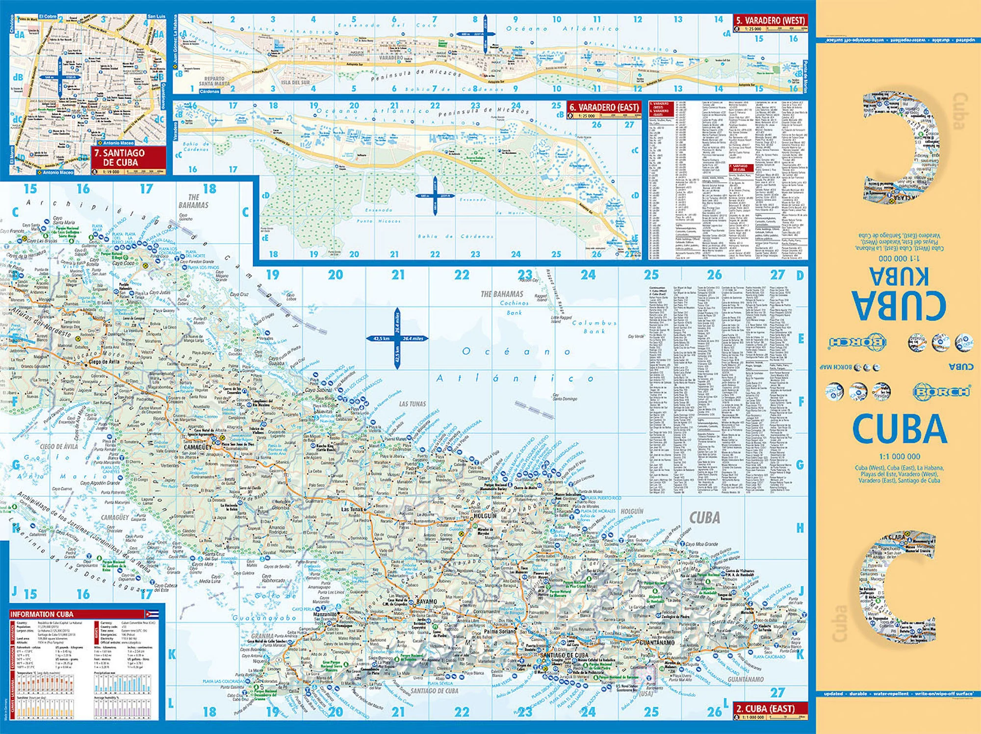
A beautifully detailed collection of Caribbean island maps, Islands of the Antilles brings together 30 individual map extracts into one elegant, highly readable composition. Published by National Geographic as part of the Atlas of the World, 11th Edition (Plate 47), this map showcases the diversity and geography of the Caribbean with clarity, precision, and refined cartographic design.
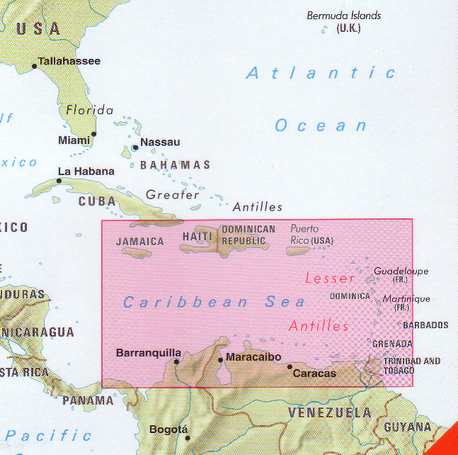
From the Bahamas to Trinidad, each island is presented with its own inset—offering a comprehensive view of one of the world’s most geographically intricate regions.
Why This Map Stands Out
30 islands in one cohesive layout
A rare multi-inset map covering the major islands of the Antilles.
Atlas-quality cartography
Derived from National Geographic’s latest atlas—accurate and beautifully balanced.
Clear and readable design
Carefully placed labels ensure excellent legibility across all insets.
Classic National Geographic styling
Features blue oceans and shaded relief perfected over decades.
A complete Caribbean reference
Ideal for understanding the region island by island.
🗺️ What the Map Shows
A curated set of inset maps covering the major islands of the Antilles, including:
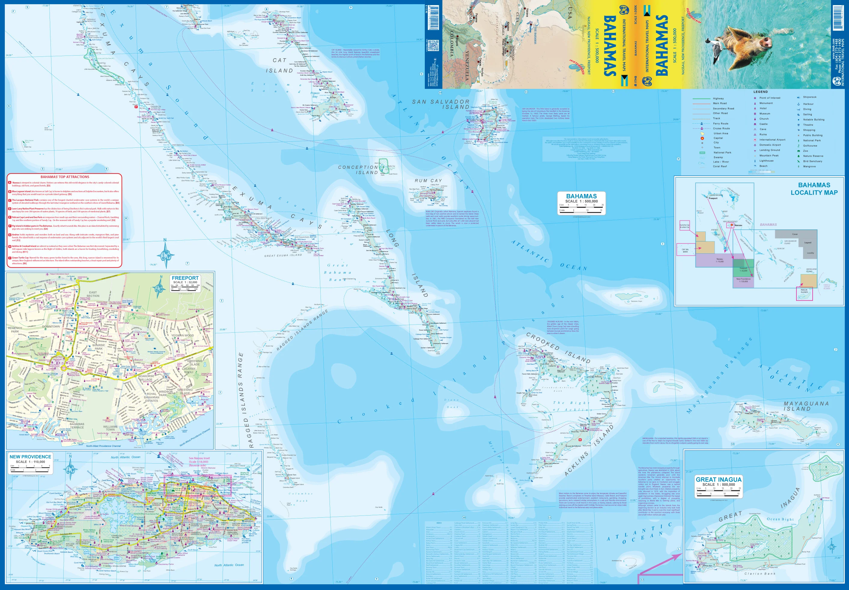
- The Bahamas: Abaco Island, Grand Bahama Island, Eleuthera, Exuma, New Providence, San Salvador Island
- Greater Antilles: Puerto Rico, Grand Cayman
- Virgin Islands: St. Croix, Tortola, St. Thomas, St. John, Virgin Gorda
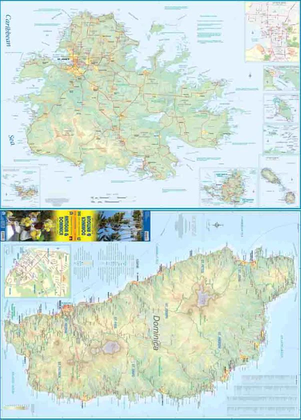
- Northern Leeward Islands: Anguilla, Saint Martin, Sint Maarten, Saint Kitts and Nevis, Antigua, Montserrat
- Central Caribbean: Guadeloupe, Dominica, Martinique, Saint Lucia, Saint Vincent, Barbados, Grenada
- Southern Caribbean: Curaçao, Aruba, Bonaire, Tobago, Trinidad
Each inset presents:
- Political boundaries and settlements
- Coastal detail and terrain shading
- A clear, individual view of each island
📐 Size & Format
798 mm (W) × 610 mm (H)
Landscape orientation
A large, information-rich format ideal for:
- Classrooms and geography education
- Travel planning and regional reference
- Offices and study spaces
- Interiors inspired by the Caribbean
✨ Premium Finishes
| Format | Description |
|---|---|
| 📜 Paper (160 gsm) | Heavyweight matte-coated paper—ideal for framing. Preserves clarity across all insets. |
| 🧼 Laminated (Encapsulated) | Sealed in 2 × 80-micron gloss laminate. Durable, wipe-clean, and perfect for reference use. |
| 🪵 Laminated + Timber Hang Rails | Laminated map mounted with lacquered natural timber rails and hanging cord—ready to display. |
| 🖼️ Canvas (395 gsm HP Professional Matte) | Printed with archival pigment inks. Enhances colour and presentation across the layout. |
| 🪵 Canvas + Timber Hang Rails | Canvas paired with timber rails for a refined, gallery-style presentation. |
🔨 Please allow up to 10 working days for professionally mounted hang-railed finishes.
📊 Specifications
| Feature | Detail |
|---|---|
| Title | Islands of the Antilles |
| Publisher | National Geographic |
| Published | 2019 |
| Source | Atlas of the World, 11th Edition (Plate 47) |
| Scale | Varies by inset |
| Dimensions | 798 mm × 610 mm |
| Orientation | Landscape |
| Map Type | Political / Regional (Inset Collection) |
| Coverage | Caribbean (Antilles) |
| Collections | Central America & Caribbean, North America |
| Materials | 160 gsm matte paper / 2 × 80-micron laminate / 395 gsm HP Professional Matte Canvas |
| Printing | Pigment-based, fade-resistant inks |
| Origin | Printed in Australia |
🎯 Ideal For
- Students and educators of Caribbean geography
- Travellers and planners exploring island destinations
- Collectors of National Geographic atlas maps
- Offices needing a comprehensive regional reference
- Gift buyers seeking a detailed and visually engaging map
🌴 A Region of Islands, Cultures & Coastlines
The Antilles are defined by diversity:
- Dozens of islands spread across warm Caribbean waters
- Unique cultures shaped by history, trade, and migration
- Landscapes ranging from volcanic peaks to coral shores
- A region connected by sea, yet distinct island by island
This map brings that diversity together—offering a clear and comprehensive view of the Caribbean’s island world.
🤝 Our Commitment
- Printed in Australia using archival-quality production
- Faithfully reproduced to preserve clarity and fine detail
- Premium materials selected for durability and long-term display
- Each map is hand-checked before dispatch
- Carefully packaged for safe delivery
🚚 Delivery
- Paper, Laminated, Canvas (rolled): Dispatch within 1–2 business days
- Hang-Railed Maps: Made to order—allow up to 10 working days
- Packaging: Securely rolled in protective tubing
Explore the Caribbean island by island—
a map that brings the Antilles into sharp, detailed focus.
👉 Order now and add a complete Caribbean reference to your wall.
Original: $50.05
-65%$50.05
$17.52Product Information
Product Information
Shipping & Returns
Shipping & Returns
Description
Inset Map Collection | Caribbean Islands in Detail | Atlas of the World, 11th Edition (798 × 610 mm) | Premium Finishes
A beautifully detailed collection of Caribbean island maps, Islands of the Antilles brings together 30 individual map extracts into one elegant, highly readable composition. Published by National Geographic as part of the Atlas of the World, 11th Edition (Plate 47), this map showcases the diversity and geography of the Caribbean with clarity, precision, and refined cartographic design.
From the Bahamas to Trinidad, each island is presented with its own inset—offering a comprehensive view of one of the world’s most geographically intricate regions.
Why This Map Stands Out
30 islands in one cohesive layout
A rare multi-inset map covering the major islands of the Antilles.
Atlas-quality cartography
Derived from National Geographic’s latest atlas—accurate and beautifully balanced.
Clear and readable design
Carefully placed labels ensure excellent legibility across all insets.
Classic National Geographic styling
Features blue oceans and shaded relief perfected over decades.
A complete Caribbean reference
Ideal for understanding the region island by island.
🗺️ What the Map Shows
A curated set of inset maps covering the major islands of the Antilles, including:
- The Bahamas: Abaco Island, Grand Bahama Island, Eleuthera, Exuma, New Providence, San Salvador Island
- Greater Antilles: Puerto Rico, Grand Cayman
- Virgin Islands: St. Croix, Tortola, St. Thomas, St. John, Virgin Gorda
- Northern Leeward Islands: Anguilla, Saint Martin, Sint Maarten, Saint Kitts and Nevis, Antigua, Montserrat
- Central Caribbean: Guadeloupe, Dominica, Martinique, Saint Lucia, Saint Vincent, Barbados, Grenada
- Southern Caribbean: Curaçao, Aruba, Bonaire, Tobago, Trinidad
Each inset presents:
- Political boundaries and settlements
- Coastal detail and terrain shading
- A clear, individual view of each island
📐 Size & Format
798 mm (W) × 610 mm (H)
Landscape orientation
A large, information-rich format ideal for:
- Classrooms and geography education
- Travel planning and regional reference
- Offices and study spaces
- Interiors inspired by the Caribbean
✨ Premium Finishes
| Format | Description |
|---|---|
| 📜 Paper (160 gsm) | Heavyweight matte-coated paper—ideal for framing. Preserves clarity across all insets. |
| 🧼 Laminated (Encapsulated) | Sealed in 2 × 80-micron gloss laminate. Durable, wipe-clean, and perfect for reference use. |
| 🪵 Laminated + Timber Hang Rails | Laminated map mounted with lacquered natural timber rails and hanging cord—ready to display. |
| 🖼️ Canvas (395 gsm HP Professional Matte) | Printed with archival pigment inks. Enhances colour and presentation across the layout. |
| 🪵 Canvas + Timber Hang Rails | Canvas paired with timber rails for a refined, gallery-style presentation. |
🔨 Please allow up to 10 working days for professionally mounted hang-railed finishes.
📊 Specifications
| Feature | Detail |
|---|---|
| Title | Islands of the Antilles |
| Publisher | National Geographic |
| Published | 2019 |
| Source | Atlas of the World, 11th Edition (Plate 47) |
| Scale | Varies by inset |
| Dimensions | 798 mm × 610 mm |
| Orientation | Landscape |
| Map Type | Political / Regional (Inset Collection) |
| Coverage | Caribbean (Antilles) |
| Collections | Central America & Caribbean, North America |
| Materials | 160 gsm matte paper / 2 × 80-micron laminate / 395 gsm HP Professional Matte Canvas |
| Printing | Pigment-based, fade-resistant inks |
| Origin | Printed in Australia |
🎯 Ideal For
- Students and educators of Caribbean geography
- Travellers and planners exploring island destinations
- Collectors of National Geographic atlas maps
- Offices needing a comprehensive regional reference
- Gift buyers seeking a detailed and visually engaging map
🌴 A Region of Islands, Cultures & Coastlines
The Antilles are defined by diversity:
- Dozens of islands spread across warm Caribbean waters
- Unique cultures shaped by history, trade, and migration
- Landscapes ranging from volcanic peaks to coral shores
- A region connected by sea, yet distinct island by island
This map brings that diversity together—offering a clear and comprehensive view of the Caribbean’s island world.
🤝 Our Commitment
- Printed in Australia using archival-quality production
- Faithfully reproduced to preserve clarity and fine detail
- Premium materials selected for durability and long-term display
- Each map is hand-checked before dispatch
- Carefully packaged for safe delivery
🚚 Delivery
- Paper, Laminated, Canvas (rolled): Dispatch within 1–2 business days
- Hang-Railed Maps: Made to order—allow up to 10 working days
- Packaging: Securely rolled in protective tubing
Explore the Caribbean island by island—
a map that brings the Antilles into sharp, detailed focus.
👉 Order now and add a complete Caribbean reference to your wall.