Portsmouth A-Z 1141 x 920mm Wall Map
Size: 1141 mm (W) x 920 mm (H)
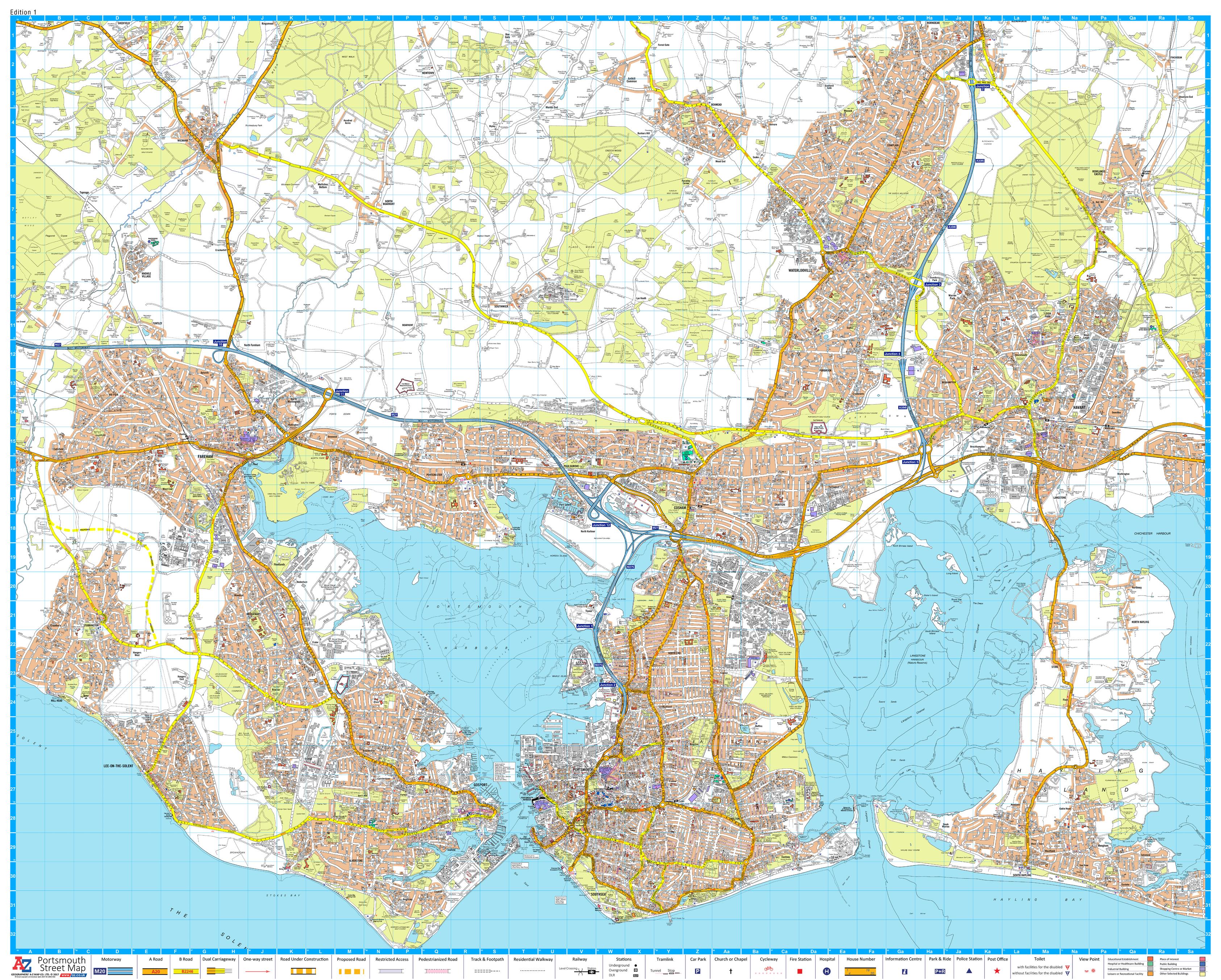
Scale: 1:17,000
Edition: First Edition, Published July 2017
Publisher: A-Z Maps
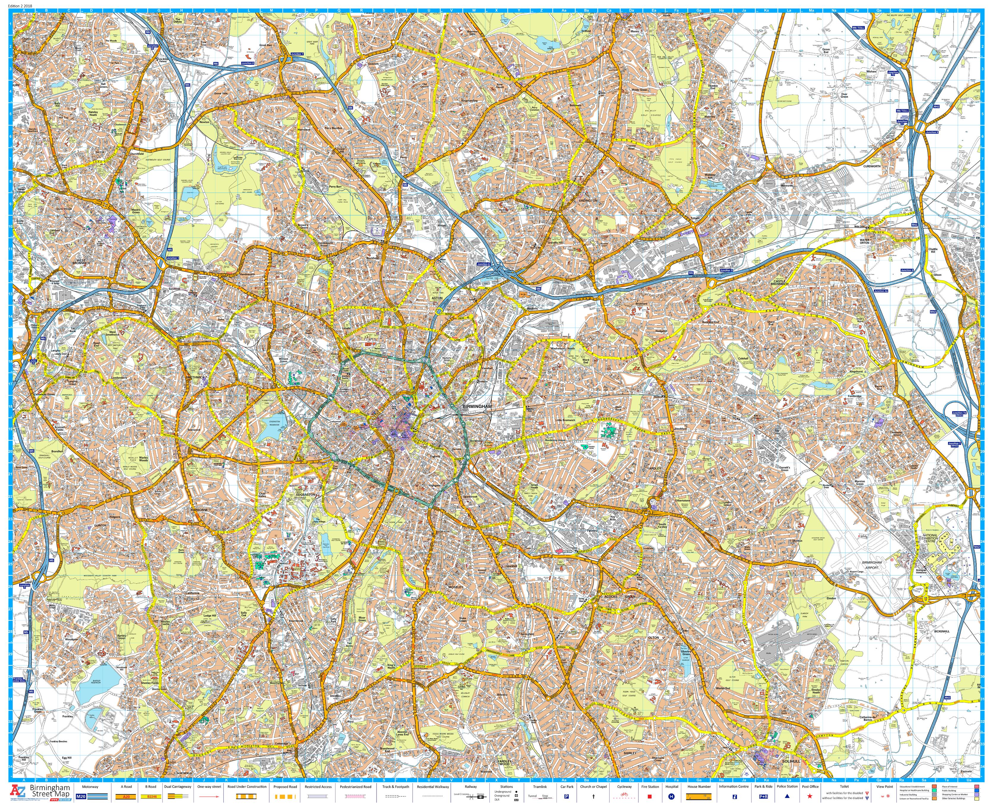
🔍 A Complete Street-Level Map of Portsmouth and Surrounding Areas
Explore the dynamic maritime city of Portsmouth and its neighbouring towns with precision using this large-format A-Z Wall Map. Ideal for planning, navigation, or display, this map offers exceptional street-level detail across a wide geographic area, extending from Fareham and Gosport in the west to Horndean, Havant, and Hayling Island in the east.
Whether you're a local authority, delivery driver, educator, property developer, or a proud resident, this wall map provides the comprehensive clarity you need. Every street, road, park, public building, and suburb is clearly labelled and easy to follow — presented in A-Z’s signature cartographic style.
🏙️ Coverage Includes:
| Primary Areas Mapped | Secondary Locations |
|---|---|
| Portsmouth (full urban detail) | Fareham, Gosport, Lee-on-the-Solent |
| Hayling Island | Stubbington, Catisfield, Waterlooville |
| Horndean & Rowland’s Castle | Wymering, Cosham, and more |
Each area is covered to a consistent scale, providing a seamless view across city and suburb.
📌 Key Features
-
🧭 Street-level detail for accurate navigation and planning
-
🚗 Ideal for routing and logistics in Portsmouth and Greater Solent area
-
🏫 Perfect for schools, councils, and planning departments
-
🖨️ Printed to A-Z’s trusted cartographic standards
-
📍 Shows major roads, minor roads, parks, public amenities, and local boundaries
📐 Specifications
| Attribute | Details |
|---|---|
| Map Type | Street Map (Urban Detail) |
| Coverage Area | Portsmouth & Surrounding Suburbs |
| Scale | 1:17,000 |
| Size | 1141 mm (wide) x 920 mm (high) |
| Publication Date | July 2017 (First Edition) |
| Publisher | Geographers’ A-Z Map Company |
🖨️ Format Options Available
| 📄 Format | 📝 Details |
|---|---|
| Paper (160 gsm) | Ideal for framing under glass or poster mounting |
| Laminated | Gloss laminated, fully encapsulated — durable and wipe-clean |
| Laminated with Hang Rails | Supplied with top and bottom timber rails and cord — ready to hang |
| Canvas (395 gsm) | Printed on heavyweight matte canvas with pigment inks — archival quality |
| Canvas with Hang Rails | Gallery-style timber rails — a classic wall display solution |
🪵 Canvas and hang rail versions are made to order. Please allow additional time for custom production.
🎯 Ideal For:
-
📦 Courier services and delivery planning
-
🏢 Local business and urban planning use
-
🏫 Educational display in classrooms and libraries
-
🏠 Home offices, garages, or study areas
-
🎁 A thoughtful gift for locals, history lovers, or map collectors
Bring the city of Portsmouth to life on your wall — whether you're navigating its historic harbours, planning your next move, or celebrating your local roots. The A-Z Portsmouth Wall Map is both a practical tool and a striking visual reference.
Original: $50.05
-65%$50.05
$17.52Product Information
Product Information
Shipping & Returns
Shipping & Returns
Description
Size: 1141 mm (W) x 920 mm (H)
Scale: 1:17,000
Edition: First Edition, Published July 2017
Publisher: A-Z Maps
🔍 A Complete Street-Level Map of Portsmouth and Surrounding Areas
Explore the dynamic maritime city of Portsmouth and its neighbouring towns with precision using this large-format A-Z Wall Map. Ideal for planning, navigation, or display, this map offers exceptional street-level detail across a wide geographic area, extending from Fareham and Gosport in the west to Horndean, Havant, and Hayling Island in the east.
Whether you're a local authority, delivery driver, educator, property developer, or a proud resident, this wall map provides the comprehensive clarity you need. Every street, road, park, public building, and suburb is clearly labelled and easy to follow — presented in A-Z’s signature cartographic style.
🏙️ Coverage Includes:
| Primary Areas Mapped | Secondary Locations |
|---|---|
| Portsmouth (full urban detail) | Fareham, Gosport, Lee-on-the-Solent |
| Hayling Island | Stubbington, Catisfield, Waterlooville |
| Horndean & Rowland’s Castle | Wymering, Cosham, and more |
Each area is covered to a consistent scale, providing a seamless view across city and suburb.
📌 Key Features
-
🧭 Street-level detail for accurate navigation and planning
-
🚗 Ideal for routing and logistics in Portsmouth and Greater Solent area
-
🏫 Perfect for schools, councils, and planning departments
-
🖨️ Printed to A-Z’s trusted cartographic standards
-
📍 Shows major roads, minor roads, parks, public amenities, and local boundaries
📐 Specifications
| Attribute | Details |
|---|---|
| Map Type | Street Map (Urban Detail) |
| Coverage Area | Portsmouth & Surrounding Suburbs |
| Scale | 1:17,000 |
| Size | 1141 mm (wide) x 920 mm (high) |
| Publication Date | July 2017 (First Edition) |
| Publisher | Geographers’ A-Z Map Company |
🖨️ Format Options Available
| 📄 Format | 📝 Details |
|---|---|
| Paper (160 gsm) | Ideal for framing under glass or poster mounting |
| Laminated | Gloss laminated, fully encapsulated — durable and wipe-clean |
| Laminated with Hang Rails | Supplied with top and bottom timber rails and cord — ready to hang |
| Canvas (395 gsm) | Printed on heavyweight matte canvas with pigment inks — archival quality |
| Canvas with Hang Rails | Gallery-style timber rails — a classic wall display solution |
🪵 Canvas and hang rail versions are made to order. Please allow additional time for custom production.
🎯 Ideal For:
-
📦 Courier services and delivery planning
-
🏢 Local business and urban planning use
-
🏫 Educational display in classrooms and libraries
-
🏠 Home offices, garages, or study areas
-
🎁 A thoughtful gift for locals, history lovers, or map collectors
Bring the city of Portsmouth to life on your wall — whether you're navigating its historic harbours, planning your next move, or celebrating your local roots. The A-Z Portsmouth Wall Map is both a practical tool and a striking visual reference.